What is SatFish?
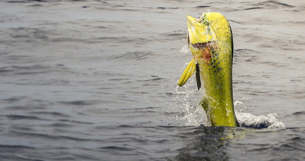
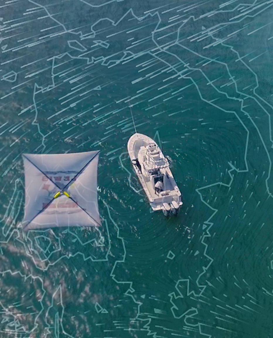
SatFish offshore fishing charts combine the latest high-def satellite sea surface temperature (SST) and chlorophyll maps with advanced planning tools to make it easy to find the most productive offshore fishing grounds for tuna, marlin, mahi, wahoo, and more. Head straight to the bite zone instead of wasting time and fuel searching through empty, lifeless water.
Learn More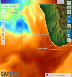
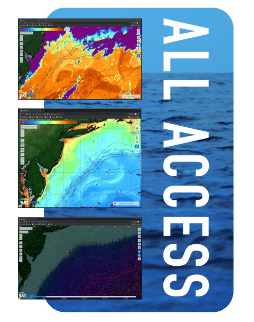
Get full access to all our regions and chart layers for just $129/year
Read the Water
Take the Guesswork Out of Finding Fish

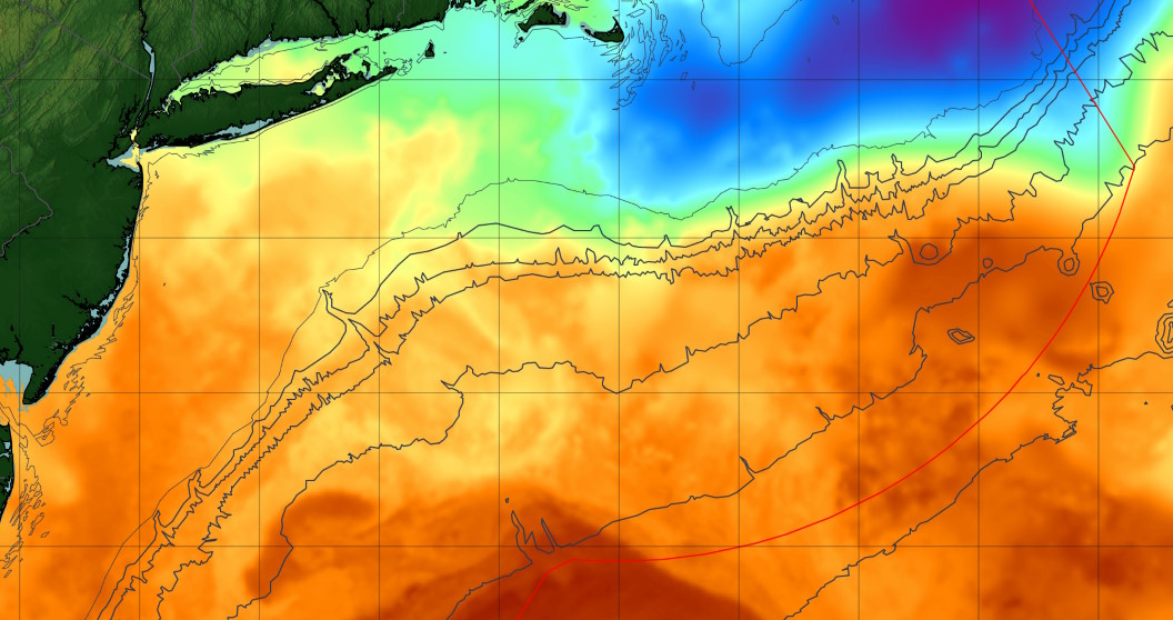
Sea Surface Temperature
We use the highest-resolution satellite Sea Surface Temperature (SST) charts available. Find the temp breaks, find the fish.

Cloud Free SST
Regular SSTs can't see through clouds, but our Cloud-Free SST maps put you in the zone even when the weather isn’t cooperating.

Chlorophyll Concentration
Surface chlorophyll concentration (Chl) shows how much plankton is in the surface layer of the ocean. Find the food, find the fish.

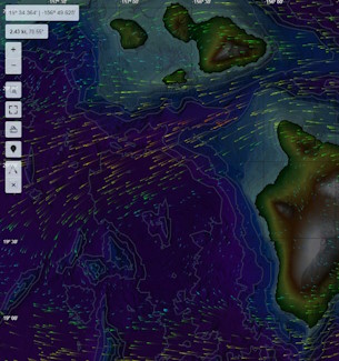
Marine Weather
Get the latest wind forecasts & buoy data to plan your trip to hit the best weather window for your fishing grounds.

Detailed Bathymetry
Detailed bathymetry shows every canyon, ledge, and drop-off, with labels for hundreds of the best fishing spots.

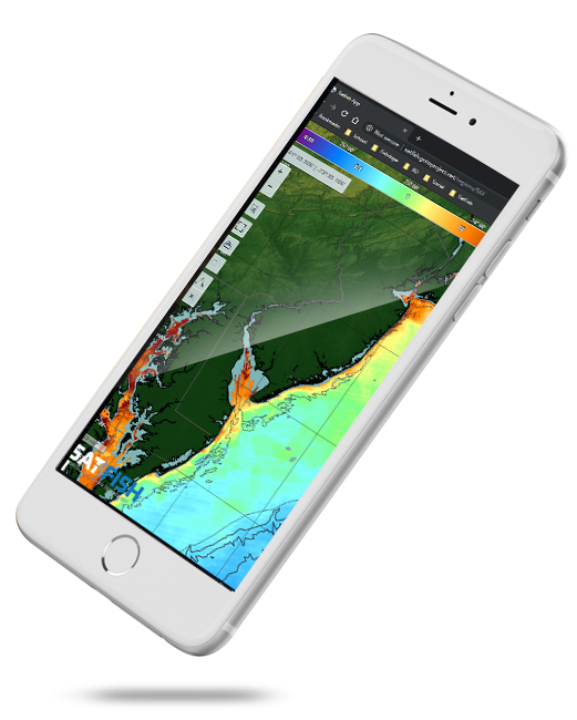
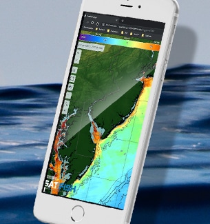
Offshore-Ready Mobile App
Bring SatFish charts with you offshore - and offline! You can even track your position right on our charts while fishing.
Built By Fishermen For Fishermen
SatFish is not just another Sea Surface Temperature chart that you could get for free.
By joining SatFish you are tapping into high-tech software built by fishermen for fishermen to process all of the most important layers of data collected from satellites as they scan the earth. These layers are processed by a Ph.D. in marine science, painting you a real-life picture of your fishing grounds. SatFish is the most powerful tool online, helping you find more fish. Knowing which way to point your boat translates directly into more fishing time, saving a ton of money on fuel and putting more fish in your holds.
With live satellite imaging, wind, sea state, currents, and more, you can make those crucial decisions to keep your crew safe and make the most of your free time.
No more running blind looking for the edge of the Gulf Stream. Need to find that warm water eddy where your buddies caught fish a few days ago? Just find it and plot it with SatFish. Built-in plotting tools let you plan and print your route before you go. It’s a fact that bait and predatory gamefish gather along the edges and breaks that form between moving bodies of water offshore. Subtle differences in temperature, color, and clarity can be a magnet for fish. You can spend too much of your precious time and fuel running around scouting the old-fashioned way. SatFish gives you the high-tech advantage, in an easy-to-use proven package. SatFish can pay for itself in fuel savings in just one trip, and how do you put a price tag on catching more fish?
Your Membership Includes:
- ✓ Full access to all regions
- ✓ Detailed bathymetry maps
- ✓ Depth contours
- ✓ Fishing hot spots
- ✓ Fishing closures and political boundaries (where available)
- ✓ Custom detailed route planning
- ✓ FREE mobile app for iOS and Android devices
 Sea Surface Temperatures:
- ✓ High-Res Sea Surface Temperature (SST) Charts (6-8 images/day)
- ✓ Cloud-Free SST (1 image/day)
- ✓ 3-Day Composite SST (1 image/day)
Water Color:
- ✓ High-res Chlorophyll Charts (2-3 images/day)
- ✓ 1-Day Composite Chlorophyll (1 image/day)
- ✓ 3-Day Composite Chlorophyll (1 image/day)
Imagery:
- ✓ ENHANCED True Color Satellite Imagery (1-3 images/day)
Satellite Altimetry:
- ✓ Sea Surface Height (1 image/day)
- ✓ Surface Currents Map (1 image/day)
Marine Weather:
- ✓ Real-time weather buoy data (updated every ~1 hour)
- ✓ 5-Day Wind Forecast (updated 4x/day)
Take SatFish Mobile with you wherever you fish!
Download the free SatFish mobile app and sign in with your membership to take SatFish on the boat with you! Track your position right on the chart - even when out of cell service - using your device's built-in GPS signal.