
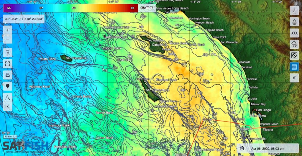
SatFish’s Southern California offshore fishing map helps SoCal anglers find the offshore sea surface temperature (SST) and water color (chlorophyll) breaks that point the way to bluefin tuna, yellowfin tuna, striped marlin, and kelp paddies holding yellowtail and dorado. Even when it’s cloudy, our cloud-free SST and 1- and 3-day composites will still point you to the right general area to look for life and gamefish. Plus, our 5-day wind forecast and live feeds to weather and swell buoys help you pick out the right window to make your run offshore.
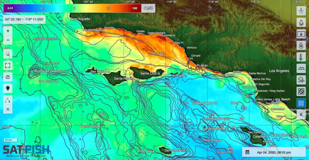
Our Southern California fishing chart covers the entire SoCal Bight and offshore fishing grounds, from Pt. Conception and the northern Channel Islands down to the inner banks off Ensenada. The map provides full coverage of Catalina and San Clemente Island out to the Tanner and Cortez Banks to keep you right on offshore gamefish wherever they roam through SoCal in the summer and fall. Whether you launch from Santa Barbara, Ventura/Channel Islands Harbor, LA, Long Beach, Newport, Dana Point, Oceanside, or San Diego, this is the chart for all your offshore, island, and coastal fishing needs.
Frequently Asked Questions
What is the Southern California offshore fishing map used for?
This map helps SoCal anglers find SST (sea surface temperature) breaks and chlorophyll edges that often hold offshore gamefish. It’s built to help you focus your run toward productive water instead of guessing.
What species can these maps help me target in Southern California?
These layers are commonly used to locate conditions for bluefin tuna, yellowfin tuna, striped marlin, and kelp paddies that can hold yellowtail and dorado. SST and chlorophyll breaks help reveal where life is most likely to stack up.
Can I still use the map when it’s cloudy?
Yes. Cloud-free SST plus 1-day and 3-day composites keep you pointed toward the best general zone when clouds block standard SST. These tools are especially helpful during typical marine layer and overcast periods.
How do wind forecasts and buoy data help with offshore planning?
The 5-day wind forecast helps you choose a safer, smoother weather window for your run. Live buoy feeds add real-time checks on wind and swell so you can adjust plans before committing to a long offshore trip.
What areas does the Southern California chart cover?
It covers the SoCal Bight and offshore grounds from Point Conception and the northern Channel Islands down to the inner banks off Ensenada. It also includes Santa Catalina Island, San Clemente Island, and offshore zones like Tanner Bank and Cortez Bank.
Which launch ports is this map best for?
This chart is designed for boats running from ports across Southern California, including Santa Barbara, Ventura, Los Angeles, Long Beach, Newport Beach, Dana Point, Oceanside, and San Diego. It’s meant to cover coastal, island, and offshore fishing from one place.