
Satfish Wind Charts display the current wind speed and a 5-day wind forecast so that you can see if it will be windy when you are out on the water. Wind forecasts are critical for planning a fishing trip to ensure that you keep your crew and vessel safely away from dangerous weather conditions and hazardous seas. Winds can change quickly, so before leaving the dock, always check our wind map along with the official marine forecasts produced by the National Weather Service (NWS/NOAA).
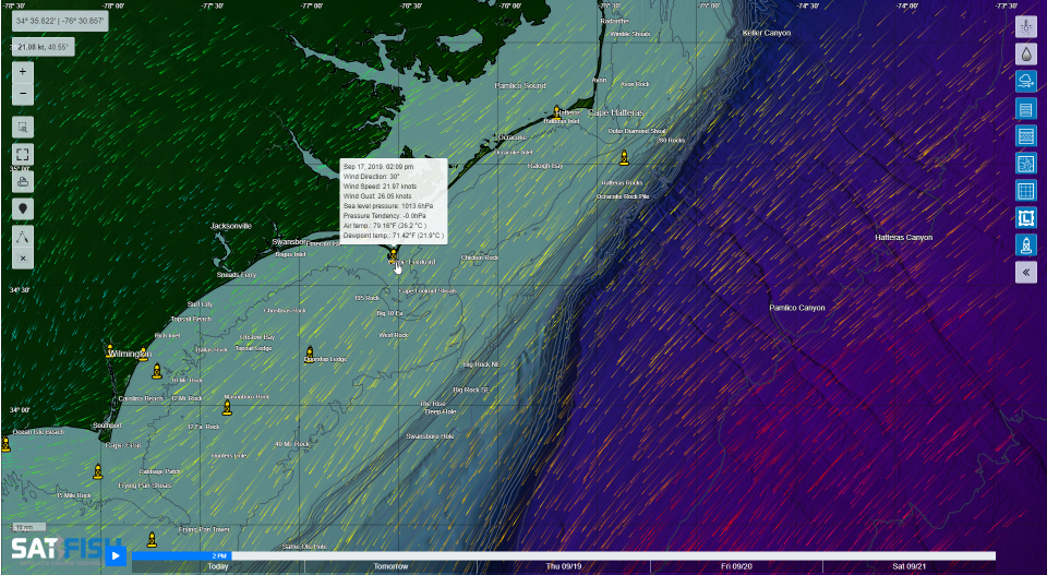
We use the latest wind forecast model data available from one of the primary models produced and used by NWS/NOAA, the Global Forecast System (GFS) model. Our wind map offers the latest now-time wind speeds updated 4 times per day, plus 3-hourly forecasts out to 3 days and 6-hourly forecasts for days 4 and 5.
The wind is generated by differences in the atmospheric pressure. In general, stronger changes in pressure mean stronger winds. As air flows from areas of high to low pressure, it is deflected due to Earth’s rotation and spherical shape. This is called the Coriolis effect and means that the wind travels counterclockwise around low pressure storms (like hurricanes and nor’easters) in the Northern Hemisphere, and clockwise south of the equator.
Winds blowing over the water generate waves. The faster, longer, and farther the wind blows, the bigger the waves. This is why it’s so important to always check the wind and waves forecasts before you head out to go fishing, to make sure that you and your vessel are prepared for the seas you will encounter – or to stay home and fish another day if conditions are too windy and rough.
Frequently Asked Questions
What do SatFish Wind Charts show?
SatFish Wind Charts show current wind speed plus a 5-day wind forecast to help you plan safe time on the water. They’re built to help you avoid dangerous weather and rough sea conditions.
How often are the wind maps updated?
Now-time wind speeds are updated 4 times per day. Forecasts are shown in 3-hour steps out to 3 days, then 6-hour steps for days 4 and 5.
What forecast model does SatFish use for wind?
SatFish uses model data from the Global Forecast System (GFS), one of the primary forecast models used by the National Weather Service (NWS/NOAA). This provides consistent wind guidance across regions and days.
Why should I still check the official marine forecast before leaving the dock?
Winds can shift quickly, and official marine forecasts include advisories, warnings, and local details. Always cross-check SatFish wind maps with NWS/NOAA marine forecasts before heading out.
How does wind relate to waves and sea conditions?
Wind blowing over the ocean creates waves, and stronger or longer-lasting winds usually build bigger seas. The faster the wind, the longer it blows, and the farther it travels over open water, the rougher conditions can get.
What is the Coriolis effect and why does it matter for wind?
The Coriolis effect is how Earth’s rotation deflects moving air, shaping wind direction around storms. In the Northern Hemisphere, winds spin counterclockwise around low-pressure systems like hurricanes and nor’easters.