

SatFish Central America Fishing Maps help offshore anglers find productive water faster using advanced satellite imagery, ocean conditions, marine weather, and trip-planning tools. From the Bahamas and Caribbean islands to the Pacific coasts of Guatemala, Costa Rica, and Panama, SatFish gives anglers the information they need to make smarter offshore runs.
Whether you’re targeting blue marlin, black marlin, sailfish, yellowfin tuna, mahi-mahi, wahoo, or other pelagic species, SatFish helps you identify the temperature breaks, water-color changes, currents, structure, and conditions that can concentrate bait and gamefish.
Why Choose SatFish for Fishing in Central America and the Caribbean?
Fishing across Central America and the Caribbean can change quickly as currents, water temperatures, bait concentrations, and weather move through the region. SatFish brings the most important offshore fishing data together in one easy-to-use map so you can determine where the best-looking water is before leaving the dock.
Here’s what sets SatFish apart:
- Advanced Satellite Data: Combine sea surface temperature (SST), chlorophyll concentration maps, detailed bathymetry, and buoy and marine weather data to build a complete picture of offshore fishing conditions.
- Find Productive Water Faster: Identify temperature breaks, chlorophyll edges, current boundaries, and water-color changes that can concentrate baitfish and offshore predators.
- Cloud-Free SST Composites: Use cloud-free SST and composite imagery to evaluate larger water-temperature patterns even when cloud cover limits fresh satellite shots.
- Plan Around Offshore Weather: Check wind and marine conditions to help determine the best window for your offshore fishing trip.
- Mobile and Offline Access: Download maps before your trip and access them offshore with the SatFish mobile app, even when you’re outside cell coverage.
- Built for Offshore Anglers: SatFish makes complex satellite and oceanographic data easier to interpret so you can spend less time searching and more time fishing.
Central America and Caribbean Fishing Map Regions
Bahamas
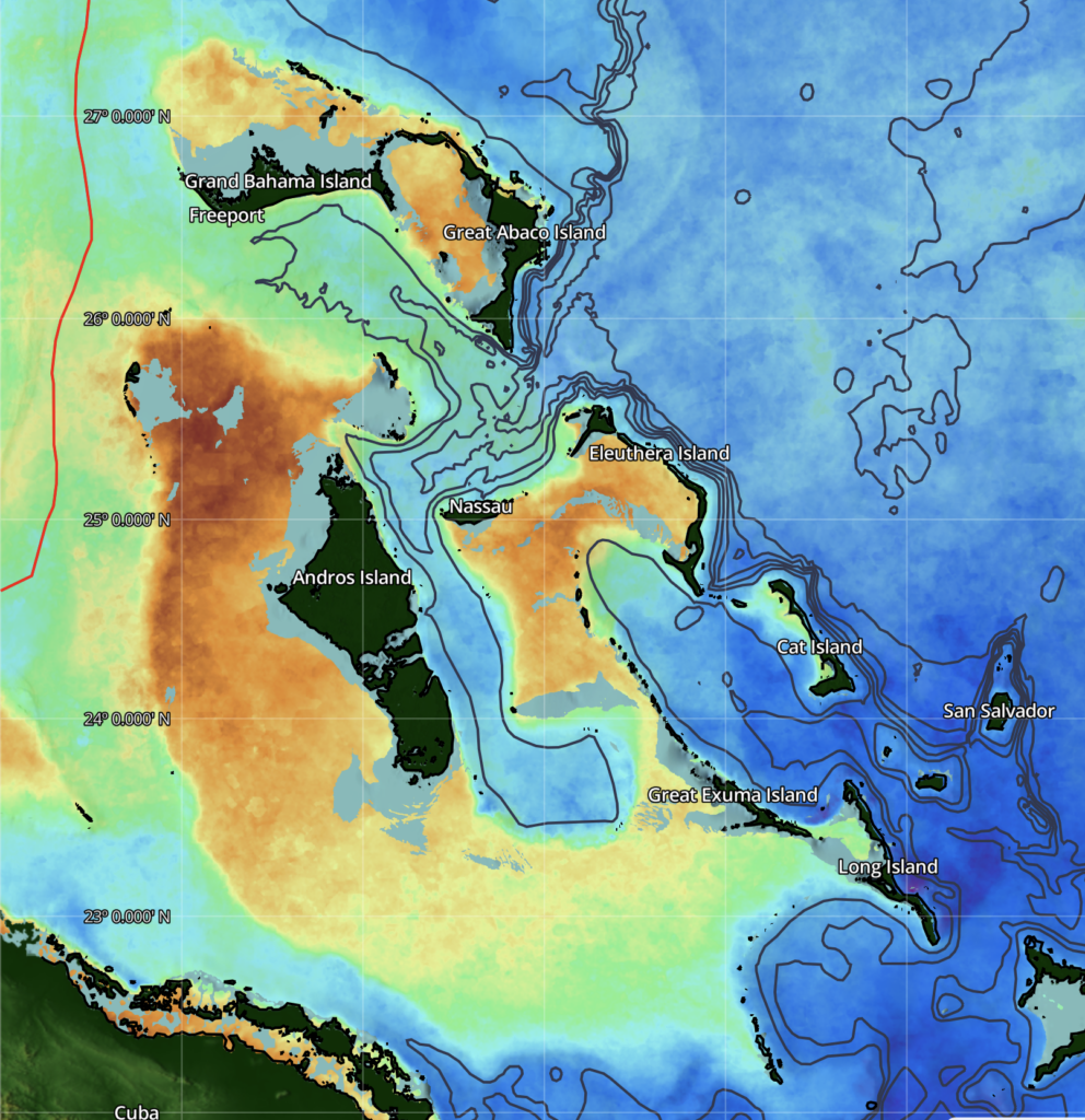
The Bahamas offers legendary bluewater fishing across deep channels, banks, drop-offs, and current-swept edges. Anglers target blue marlin, yellowfin tuna, mahi-mahi, wahoo, and other pelagic species throughout this expansive island chain.
SatFish Bahamas Fishing Maps help anglers identify productive temperature breaks, clean-water edges, currents, and offshore structure before deciding where to make their run.
Click here to read more about SatFish’s Bahamas Offshore Fishing Maps
Turks and Caicos
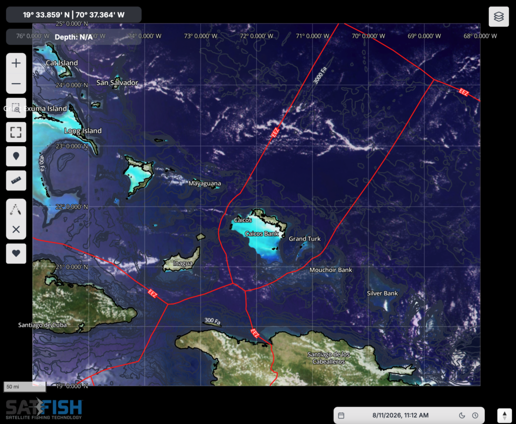
Turks and Caicos combines steep offshore drop-offs with warm Caribbean and Atlantic waters, creating excellent conditions for blue marlin, mahi-mahi, wahoo, tuna, and other offshore gamefish.
SatFish Turks and Caicos Fishing Maps provide satellite imagery and offshore conditions that help anglers narrow down productive water along the islands, banks, and surrounding deepwater fishing grounds.
Click here to read more about SatFish’s Turks and Caicos Offshore Fishing Maps
Caribbean Overview
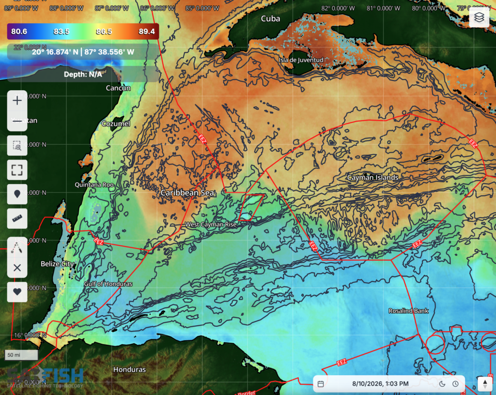
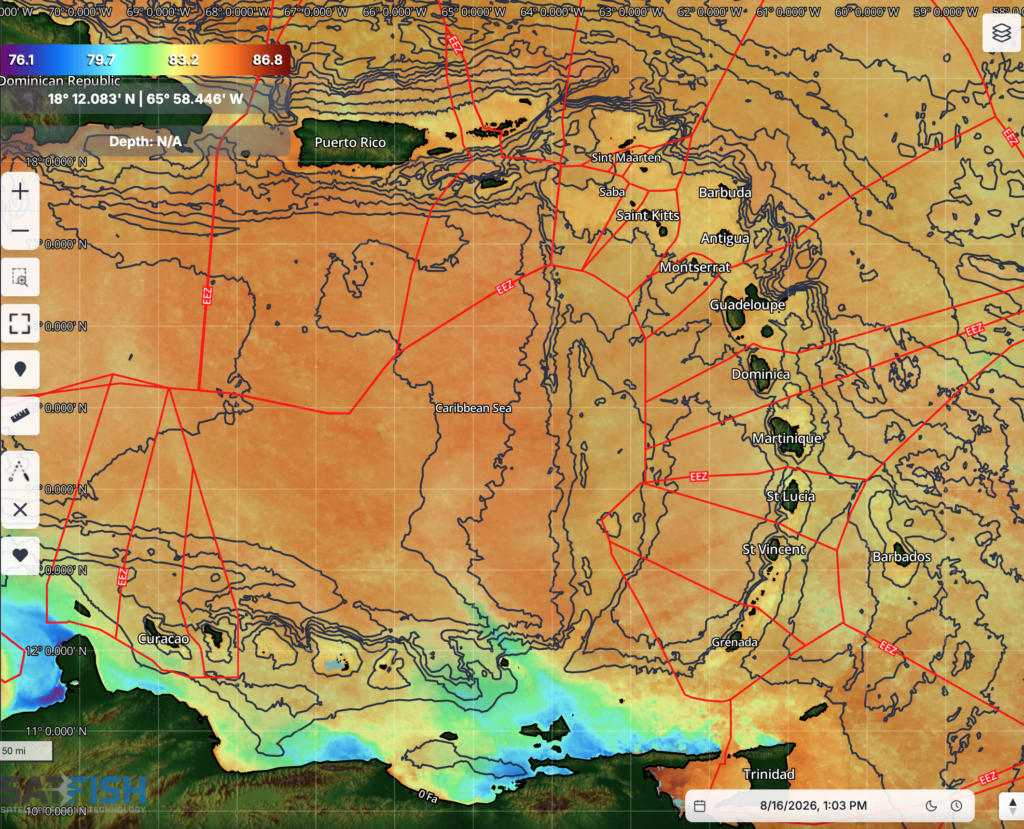
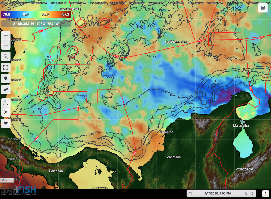
The Caribbean offers an enormous range of offshore fishing opportunities, from deepwater channels and island drop-offs to current edges and offshore banks. Blue marlin, white marlin, sailfish, tuna, mahi-mahi, and wahoo are among the prized species found throughout the region.
SatFish Caribbean Fishing Maps help anglers evaluate SST, chlorophyll, water color, currents, structure, and weather to identify promising offshore fishing areas.
Click here to read more about SatFish’s Caribbean Overview Offshore Fishing Maps
Puerto Rico
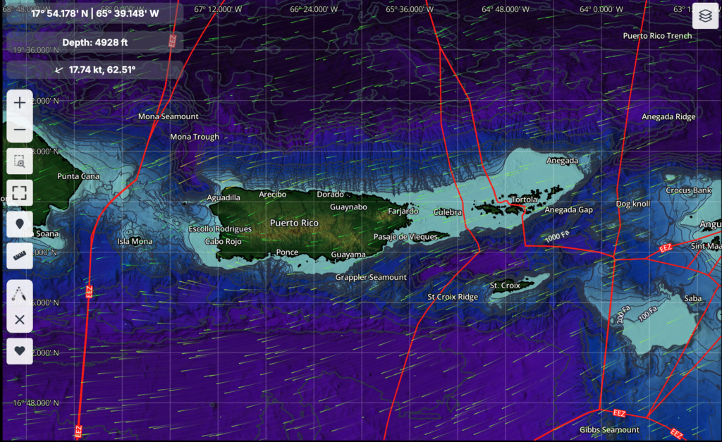
Puerto Rico is surrounded by deep blue water and dramatic underwater structure, providing offshore anglers with opportunities for blue marlin, white marlin, mahi-mahi, wahoo, tuna, and other pelagic species.
SatFish Puerto Rico Fishing Maps make it easier to track changing offshore conditions and identify productive water along current edges, temperature breaks, drop-offs, and deepwater structure.
Click here to read more about SatFish’s Puerto Rico Offshore Fishing Maps
Leeward Islands
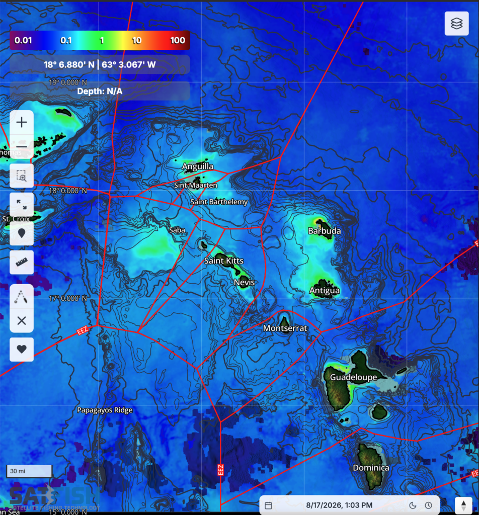
The Leeward Islands provide access to productive Caribbean and Atlantic waters where steep drop-offs, currents, and warm blue water create prime habitat for marlin, tuna, mahi-mahi, wahoo, and other pelagic fish.
SatFish Leeward Islands Fishing Maps help anglers compare satellite imagery, water conditions, structure, and weather when planning offshore trips throughout the region.
Click here to read more about SatFish’s Leeward Islands Offshore Fishing Maps
Windward Islands
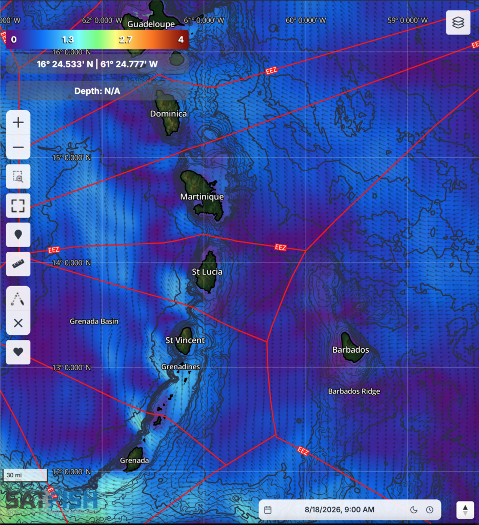
The Windward Islands sit along productive current paths in the eastern Caribbean, with deep offshore waters close to many of the islands. These conditions provide opportunities to target blue marlin, sailfish, tuna, mahi-mahi, wahoo, and other offshore species.
SatFish Windward Islands Fishing Maps help identify changing SST, chlorophyll, water-color edges, currents, and offshore structure so anglers can focus on the best-looking water.
Click here to read more about SatFish’s Windward Islands Offshore Fishing Maps
Jamaica
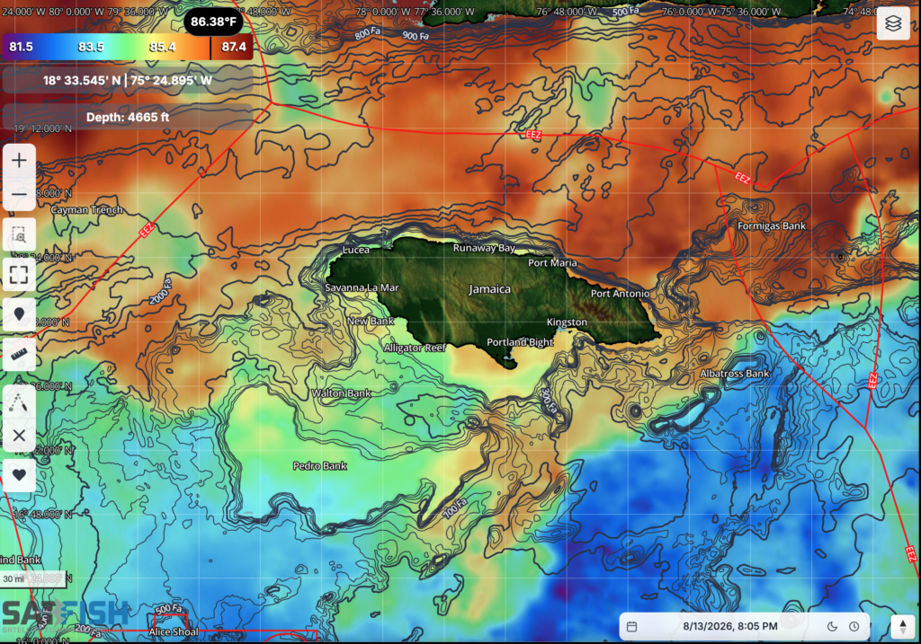
Jamaica’s steep offshore drop-offs provide quick access to deep Caribbean waters and productive fishing grounds for blue marlin, tuna, mahi-mahi, wahoo, and other pelagic species.
SatFish Jamaica Fishing Maps give offshore anglers a better view of temperature breaks, water-color changes, currents, bathymetry, and weather conditions when planning where to fish.
Click here to read more about SatFish’s Jamaica Offshore Fishing Maps
Guatemala / El Salvador / Nicaragua
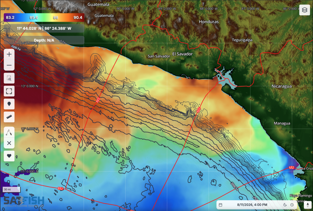
The Pacific coasts of Guatemala, El Salvador, and Nicaragua are known for outstanding offshore fishing, including one of the world’s most famous sailfish fisheries. Anglers can also encounter blue and black marlin, yellowfin tuna, mahi-mahi, and other pelagic species.
SatFish Fishing Maps for Guatemala, El Salvador, and Nicaragua help anglers track Pacific SST breaks, chlorophyll edges, currents, and offshore conditions to identify productive water and plan more efficient runs.
Click here to read more about SatFish’s Guatemala, El Salvador, and Nicaragua Offshore Fishing Maps
Costa Rica / Panama
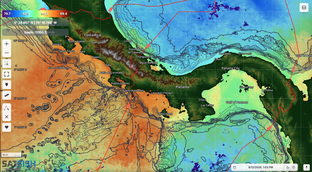
Costa Rica and Panama are among Central America’s premier offshore fishing destinations, with productive Pacific waters supporting sailfish, blue and black marlin, yellowfin tuna, mahi-mahi, and other gamefish.
SatFish Costa Rica and Panama Fishing Maps help anglers locate temperature breaks, chlorophyll edges, current boundaries, offshore structure, and other conditions that may concentrate bait and pelagic fish.
Click here to read more about SatFish’s Costa Rica and Panama Offshore Fishing Maps
How SatFish Mapping Works
Getting started with SatFish makes it easier to turn changing offshore conditions into a practical fishing plan:
- Choose Your Fishing Region: Select the Central America or Caribbean region covering the waters you plan to fish.
- Check the Latest Satellite Imagery: Review SST, chlorophyll, water color, currents, and other available oceanographic layers.
- Find High-Percentage Water: Look for temperature breaks, color changes, current edges, structure, and areas where multiple favorable conditions overlap.
- Plan Your Offshore Route: Build a route that efficiently intersects the best-looking water instead of spending valuable time and fuel searching blindly.
- Check the Weather: Review wind and marine forecasts to determine whether conditions line up with your fishing plans.
- Download Before You Go: Save maps to the SatFish mobile app for access when you’re beyond cellular coverage.
- Adjust as Conditions Change: Compare recent and historical imagery to see how productive water is moving and refine your fishing plan.
Frequently Asked Questions
What is the best satellite fishing map for Central America and the Caribbean?
SatFish provides satellite fishing maps for Central America and the Caribbean that combine sea surface temperature, chlorophyll, water-color data, currents, bathymetry, and marine weather. These tools help offshore anglers identify productive water and plan fishing trips for tuna, marlin, sailfish, mahi-mahi, wahoo, and other pelagic species.
How can satellite fishing maps help find tuna and marlin in Central America?
Satellite fishing maps can reveal temperature breaks, chlorophyll edges, current boundaries, and changes in water color where baitfish and offshore predators may concentrate. SatFish helps anglers identify these areas before leaving the dock so they can focus their fishing effort on higher-percentage water.
What Central America and Caribbean fishing regions does SatFish cover?
SatFish offers fishing map coverage for the Bahamas, Turks and Caicos, Caribbean, Puerto Rico, Leeward Islands, Windward Islands, Jamaica, Guatemala, El Salvador, Nicaragua, Costa Rica, and Panama.
Can I use SatFish offshore without an internet connection?
Yes. Anglers can download maps before their trip using the SatFish mobile app and access downloaded information while offshore, making SatFish useful when fishing beyond cellular coverage.
What should I look for on SatFish before an offshore fishing trip?
Start by looking for sea surface temperature breaks, chlorophyll and water-color edges, current boundaries, and productive offshore structure. Then compare these features with recent conditions and the marine forecast. Areas where several favorable conditions overlap can provide a strong starting point for your fishing plan.
Find Better Water with SatFish
Offshore fishing across Central America and the Caribbean covers a huge amount of water, and conditions can change quickly. SatFish helps narrow the search by putting satellite imagery, ocean conditions, structure, and weather information in one place.
Instead of spending your day searching miles of open ocean, use SatFish Central America Fishing Maps to identify the best-looking water first, plan a smarter route, and adjust as conditions evolve.
Get started with SatFish or contact us to learn more.