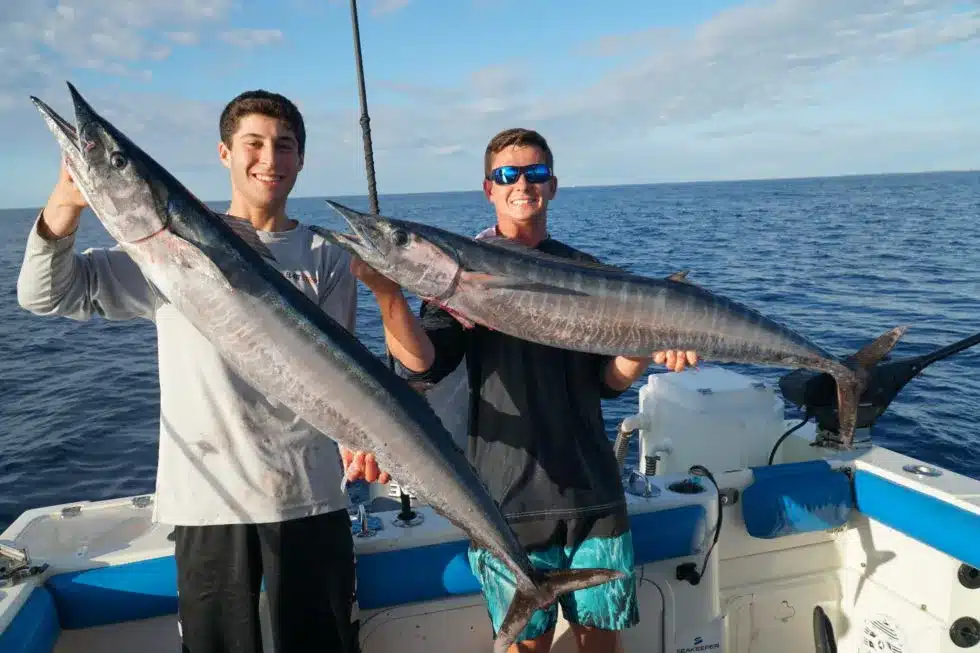
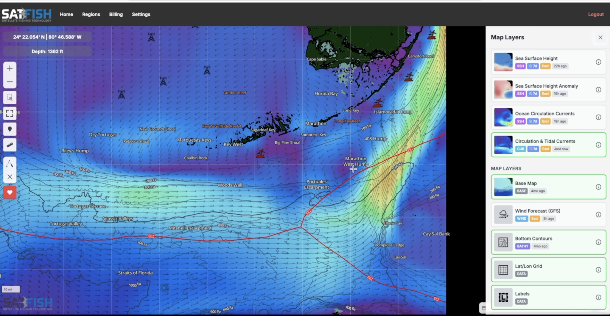
SatFish is a satellite fishing platform built by fishermen to help Atlantic anglers find productive water faster, so you spend less time searching and more time fishing.
Discover the Power of SatFish for Atlantic Fishing
SatFish helps Atlantic anglers find productive water faster with high-def satellite data, so you save fuel and target tuna, marlin, mahi, wahoo, and more.
Why Choose SatFish?
SatFish simplifies your fishing plans while maximizing efficiency:
- Combines sea surface temperature (SST) imagery, chlorophyll maps, wind forecasts, buoy data, and detailed bathymetry into one powerful interface.
- Allows you to find temperature breaks, plankton blooms, and underwater structures, directing you to prime fishing waters.
- Uses advanced marine science analysis to process multi-layered satellite data, offering cloud-free SST composites and historical animations.
- Mobile app features offline access and GPS-enabled tracking for real-time navigation while at sea.
We Have Fishing Maps For These Regions
Gulf of Maine

Use SST, chlorophyll, and bottom contours to locate temperature breaks, bait concentrations, and productive offshore structure for tuna and pelagic species throughout the Gulf of Maine.
Cape Cod / Georges Bank
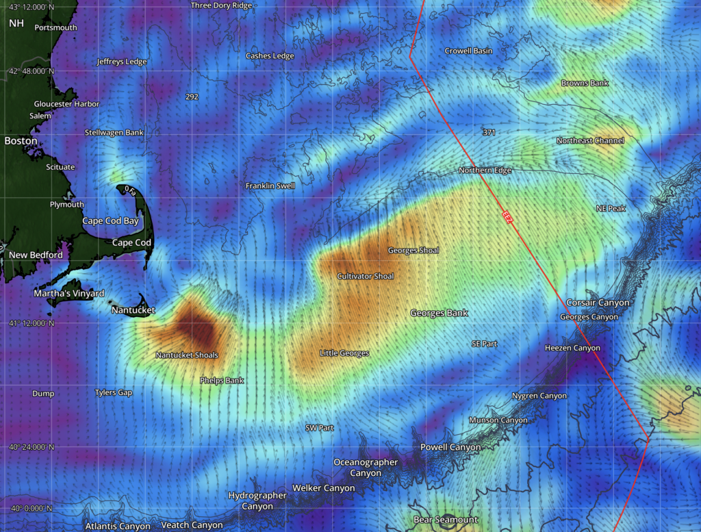
Dial in temp breaks, bait edges, and bank structure that can hold everything from schoolies to giants when conditions set up right.
Read more about SatFish’s Cape Cod / Georges Bank Offshore Fishing Maps
Northeast Canyons

Built for serious offshore runs, use SST, chlorophyll, and bathymetry to line up canyon walls, current seams, and life-rich boundaries.
Read more about SatFish’s Northeast Canyons Bank Offshore Fishing Maps
North Carolina / Outer Banks
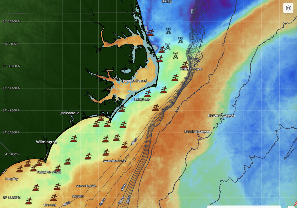
Track Gulf Stream rips and blue-water pushes that can turn the edge into a mixed-bag bite for tuna, billfish, and wahoo.
Read more about SatFish’s North Carolina / Outer Banks Offshore Fishing Maps
South Carolina / Georgia
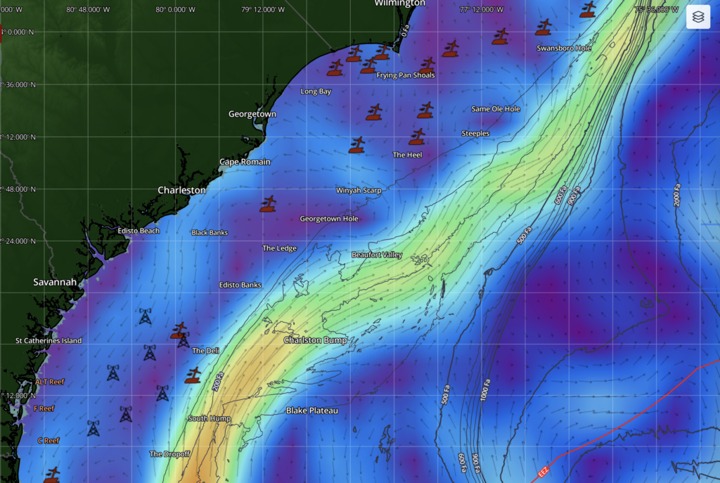
Find the clean-water lanes, ledges, and current transitions that often concentrate bait and improve your odds on longer offshore runs.
Read more about SatFish’s South Carolina Offshore Fishing Maps
Florida
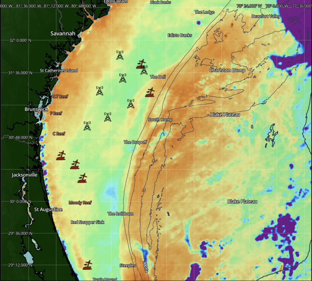
From nearshore pushes to deep blue water, use SatFish layers to spot rips, eddies, and structure-driven zones without burning fuel searching.
Read more about SatFish’s Florida Offshore Fishing Maps
Bahamas
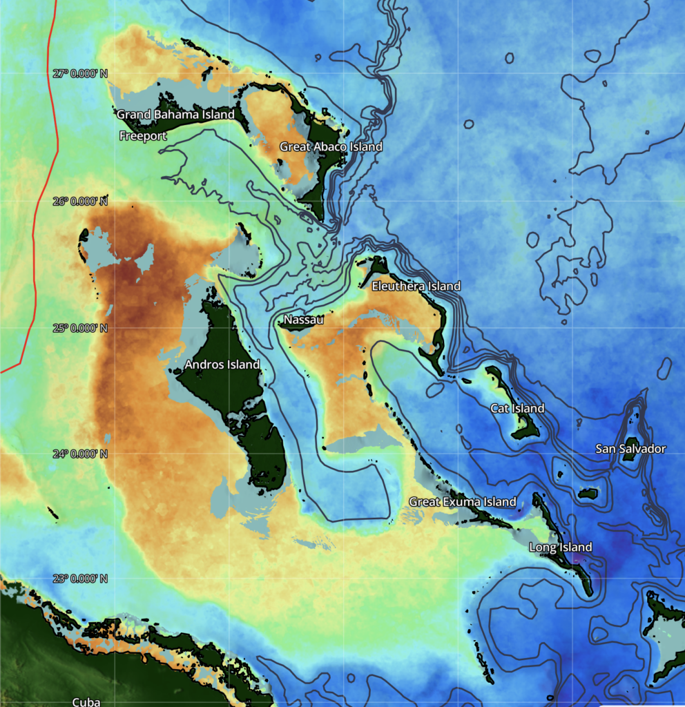
Great for reading clear-water gradients and current flow around island edges where pelagics like to patrol and feed.
Read more about SatFish’s Bahamas Offshore Fishing Maps
How It Works
Step 1: Accessing the Platform
Log in to SatFish and explore Atlantic-focused map features through a user-friendly interface with easy-to-use data layers.
Step 2: Analyze Data
Dive into detailed SST charts and chlorophyll maps to determine potential fish hotspots.
Leverage historical data animations to predict the movement of favorable water conditions and fish gatherings.
Step 3: Plan Your Route
Use the route planning tools to plot your course before you even leave the dock. Ensure that you’re heading to areas with the most promise using precise navigational insights.
Step 4: Optimize Your Fishing Trip
Activate the mobile app to stay updated with offline access to charts and real-time positioning on the water. Monitor dynamic changes in water properties and adjust your strategies on the go.
Frequently Asked Questions
How does SatFish save me time on the water?
By showing you detailed maps of current sea conditions, SatFish eliminates much of the guesswork involved in finding fish, letting you go straight to the areas where fish are likely to be biting.
What makes SatFish different from basic SST charts?
SatFish provides a multi-dimensional look at marine environments by integrating SST data with other crucial factors like chlorophyll concentration and bathymetry, all processed through advanced marine science.
Is the SatFish app necessary for maximizing the platform?
The app enhances your experience by allowing offline chart access and GPS tracking while at sea. This feature is especially useful for dynamic decision-making while fishing offshore.
Can I use SatFish beyond the Atlantic region?
Absolutely, SatFish offers maps and tools tailored to various regions, making it a versatile choice for anglers worldwide.
Does SatFish offer insights into specific fish species?
Yes, with detailed species profiles such as the Atlantic Bluefin Tuna species profile, you gain insights into behaviors, habitats, and the best times to target these species.
Ready to Supercharge Your Fishing Journey?
Dive into a world of precise, cutting-edge marine insights designed to save you time and fuel, and deliver better, more rewarding fishing experiences. Learn more by visiting our About Satfish Offshore Fishing Maps. Connect with us today to transform how you fish the Atlantic!