Satfish Fishing Charts

Satfish Fishing Charts

Satellite Fishing Technology

MENUMENU
  • Map Features
    • Sea Surface Temperature Charts
    • Unfiltered (Raw) SST Charts
    • Cloud Free SST Charts
    • Chlorophyll Concentration Maps
    • Wind Forecasts
    • Fishing Hot Spots
    • Mobile Apps
  • Regions
    • West Coast
      • Pacific Northwest
        • Vancouver Island
        • Washington
        • Westport / Ilwaco
        • Oregon
        • S. Oregon / N. California
      • Northern California
      • Central California
      • Southern California
      • Hawaii
        • Kauai
        • Oahu
        • Maui
        • Big Island
    • Mexico
      • Baja California
        • Ensenada
        • Cedros Island
        • Magdalena Bay
        • Cabo San Lucas / East Cape
        • San Felipe
        • Bahia de Los Angeles
        • Santa Rosalia / Mulege
        • Loreto
        • La Paz
      • Puerto Vallarta
    • Gulf Of Mexico
      • Texas Coast
      • Louisiana
      • Florida Gulf Coast
        • Destin / FL Panhandle
        • Tampa / Middle Grounds
        • Cape Coral / Fort Myers
    • Atlantic Ocean
      • Cape Cod / Georges Bank
      • Northeast Canyons
      • North Carolina / Outer Banks
      • South Carolina
      • Georgia
      • Florida
        • Jacksonville
        • East Central
        • Miami
        • Florida Keys
      • Bahamas
  • How-To
    • Getting Started
    • How to Use SST & Chloro Charts
    • How to Catch Wahoo
    • How to Catch Dolphin
    • How to Catch Cobia
    • How to Catch Albacore
  • About
    • SatFish Blog
    • About SatFish
    • Reviews & Testimonials
    • Ambassadors
    • Frequently Asked Questions
  • Free Trial
  • Log In
☰
Satfish Fishing Charts
×
MENUMENU
  • Map Features
    • Sea Surface Temperature Charts
    • Unfiltered (Raw) SST Charts
    • Cloud Free SST Charts
    • Chlorophyll Concentration Maps
    • Wind Forecasts
    • Fishing Hot Spots
    • Mobile Apps
  • Regions
    • West Coast
      • Pacific Northwest
        • Vancouver Island
        • Washington
        • Westport / Ilwaco
        • Oregon
        • S. Oregon / N. California
      • Northern California
      • Central California
      • Southern California
      • Hawaii
        • Kauai
        • Oahu
        • Maui
        • Big Island
    • Mexico
      • Baja California
        • Ensenada
        • Cedros Island
        • Magdalena Bay
        • Cabo San Lucas / East Cape
        • San Felipe
        • Bahia de Los Angeles
        • Santa Rosalia / Mulege
        • Loreto
        • La Paz
      • Puerto Vallarta
    • Gulf Of Mexico
      • Texas Coast
      • Louisiana
      • Florida Gulf Coast
        • Destin / FL Panhandle
        • Tampa / Middle Grounds
        • Cape Coral / Fort Myers
    • Atlantic Ocean
      • Cape Cod / Georges Bank
      • Northeast Canyons
      • North Carolina / Outer Banks
      • South Carolina
      • Georgia
      • Florida
        • Jacksonville
        • East Central
        • Miami
        • Florida Keys
      • Bahamas
  • How-To
    • Getting Started
    • How to Use SST & Chloro Charts
    • How to Catch Wahoo
    • How to Catch Dolphin
    • How to Catch Cobia
    • How to Catch Albacore
  • About
    • SatFish Blog
    • About SatFish
    • Reviews & Testimonials
    • Ambassadors
    • Frequently Asked Questions
  • Free Trial
  • Log In
Built By Fishermen For Fishermen
Sign up now for a FREE 30-day trial!
Free Trial
Capt. Arturo Chacon from Tag Cabo Sportfishing in Cabo San Lucas, BCS, Mexico with a roosterfish

Capt. Arturo Chacon
Tag Cabo Sportfishing


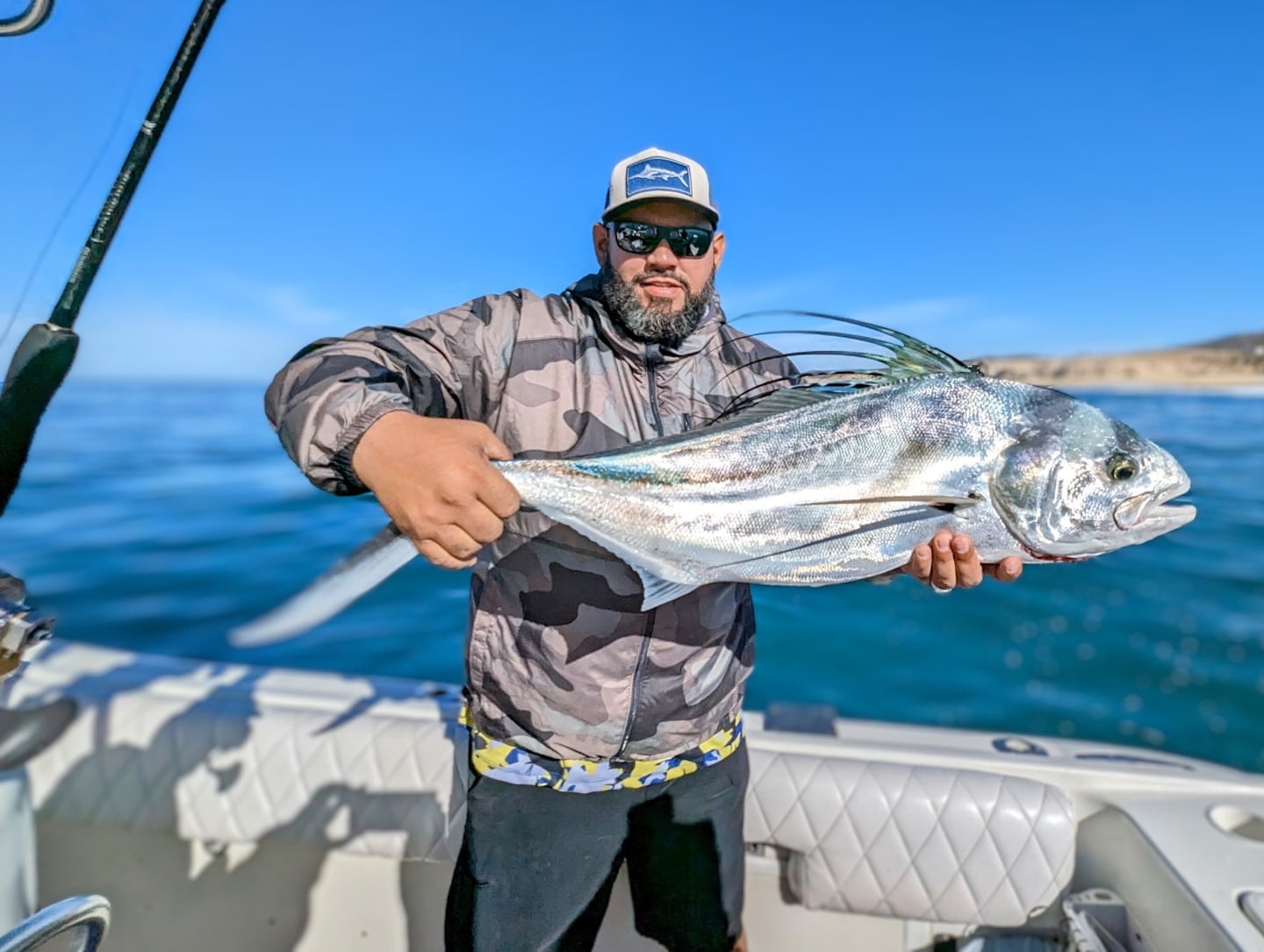
Captain Arturo Chacon is the owner and operator of Tag Cabo Sportfishing in Cabo San Lucas, Baja California Sur, Mexico, but more than anything he is a passionate angler.

Capt. Arturo is always on the lookout for new tools and technologies that can enhance the fishing experience for himself and his valued clients. He is thrilled to introduce others to SatFish, which he refers to as “a groundbreaking technology that is changing the way we approach offshore angling.”

I used other apps for many years, but upon discovering the SATFISH app a couple years ago I instantly fell in love with it.

– Capt. Arturo Chacon

When asked why he chooses to use SatFish, Arturo states:

As the owner of Tag Cabo Sportfishing, I can attest to the numerous advantages of using SatFish:

1. Increased Efficiency: SatFish helps us locate productive spots quickly and easily, reducing the time spent searching for fish and ensuring a more enjoyable experience for our clients.

2. Improved Safety: Access to real-time weather and buoy data allows us to monitor changing conditions and make informed decisions about our safety and that of our clients while out on the water.

3. Enhanced Trip Planning: The advanced trip planning tools offered by SatFish help us optimize our time on the water by planning routes, calculating fuel consumption, and more.

4. Greater Success: Ultimately, the information and tools provided by SatFish help us catch more fish, leading to happier clients and a more successful charter operation.

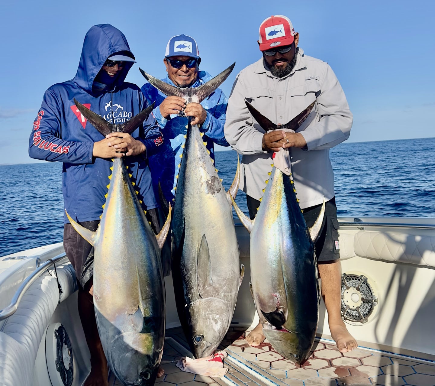
Arturo maintains a blog for all things fishing in Cabo, and he regularly writes about how he uses SatFish and how it has revolutionized the fishing experience for him and his clients. Arturo also shares how he uses SatFish to target yellowfin tuna like these pictured below.

Capt. Arturo Chacon and Tag Cabo Sportfishing in Cabo San Lucas, BCS, Mexico catching three big yellowfin tuna

Arturo consistently fulfills his clients’ dreams by making unforgettable memories, exploring the incredible waters off the coast of Cabo San Lucas, and catching more fish with the help of SatFish.

Connect with Capt. Arturo:​
​Tag Cabo Sportfishing website
Tag Cabo Sportfishing on YouTube
Tag Cabo Sportfishing on Instagram

Share:

Primary Sidebar

Recent Posts

SatFish Blog

Recent Posts

Five Tips for Making Mahi-Mahi Mayhem

Finding Yellowfin Off Floridas East Coast

Current Events

Your Membership Includes:

Your Membership Includes:

  • ✓ Full access to all regions
  • ✓ Detailed bathymetry maps
  • ✓ Depth contours
  • ✓ Fishing hot spots
  • ✓ Fishing closures and political boundaries (where available)
  • ✓ Custom detailed route planning
  • ✓ FREE mobile app for iOS and Android devices
 

Sea Surface Temperatures:

  • ✓ High-Res Sea Surface Temperature (SST) Charts (6-8 images/day)
  • ✓ Cloud-Free SST (1 image/day)
  • ✓ 3-Day Composite SST (1 image/day)
 

Water Color:

  • ✓ High-res Chlorophyll Charts (2-3 images/day)
  • ✓ 1-Day Composite Chlorophyll (1 image/day)
  • ✓ 3-Day Composite Chlorophyll (1 image/day)
 

Imagery:

  • ✓ ENHANCED True Color Satellite Imagery (1-3 images/day)
 

Satellite Altimetry:

  • ✓ Sea Surface Height (1 image/day)
  • ✓ Surface Currents Map (1 image/day)
 

Marine Weather:

  • ✓ Real-time weather buoy data (updated every ~1 hour)
  • ✓ 5-Day Wind Forecast (updated 4x/day)
Free 30 Day Trial

Footer

Start A FREE

30-Day Trial!

Join today for a FREE 30-day trial!

Only $129 per year

Free Trial
logo
© 2024 SatFish. All Rights Reserved.
  • My Account
  • Contact
  • Technical Support
  • Terms
  • Privacy Policy