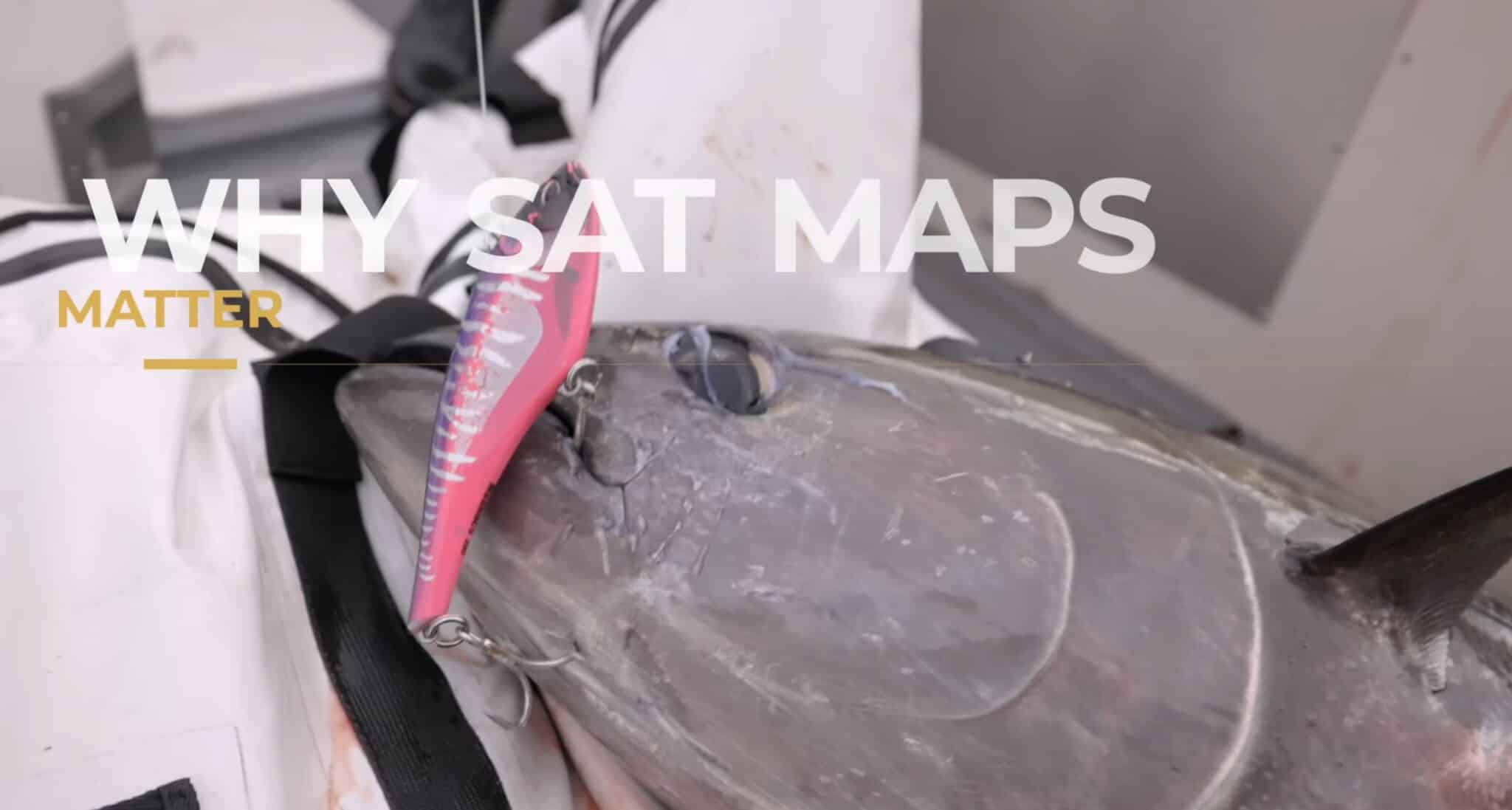
Ever wonder how offshore anglers consistently find tuna before leaving the dock? In this video, we break down exactly how we use temperature maps and chlorophyll maps to locate bluefin and albacore tuna. We go over why these breaks are the key to finding bait and life offshore. We’ll walk through real world examples from… READ MORE
In this step-by-step tutorial, Captain Ali Hussainy from Local Knowledge walks you through all the essential tools and features of the SatFish mapping interface, available on both desktop and mobile apps. Learn how to effectively use high-definition Sea Surface Temperature (SST) maps, chlorophyll charts, GPS coordinates, cloud-free imaging, and route-planning features to maximize your offshore… READ MORE
In this video, we walk through how to use Satfish to plan your offshore fishing trips more effectively. Starting from the Satfish dashboard, you’ll learn how to navigate regional maps—like the Baja, Los Cabos, and East Cape zones—and use satellite imagery to track sea surface temperatures (SST) and chlorophyll levels. Follow along as we monitor… READ MORE
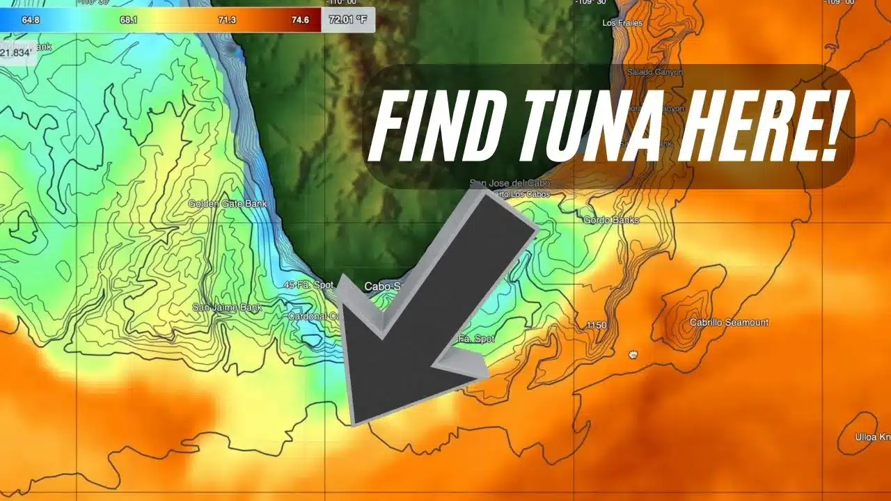
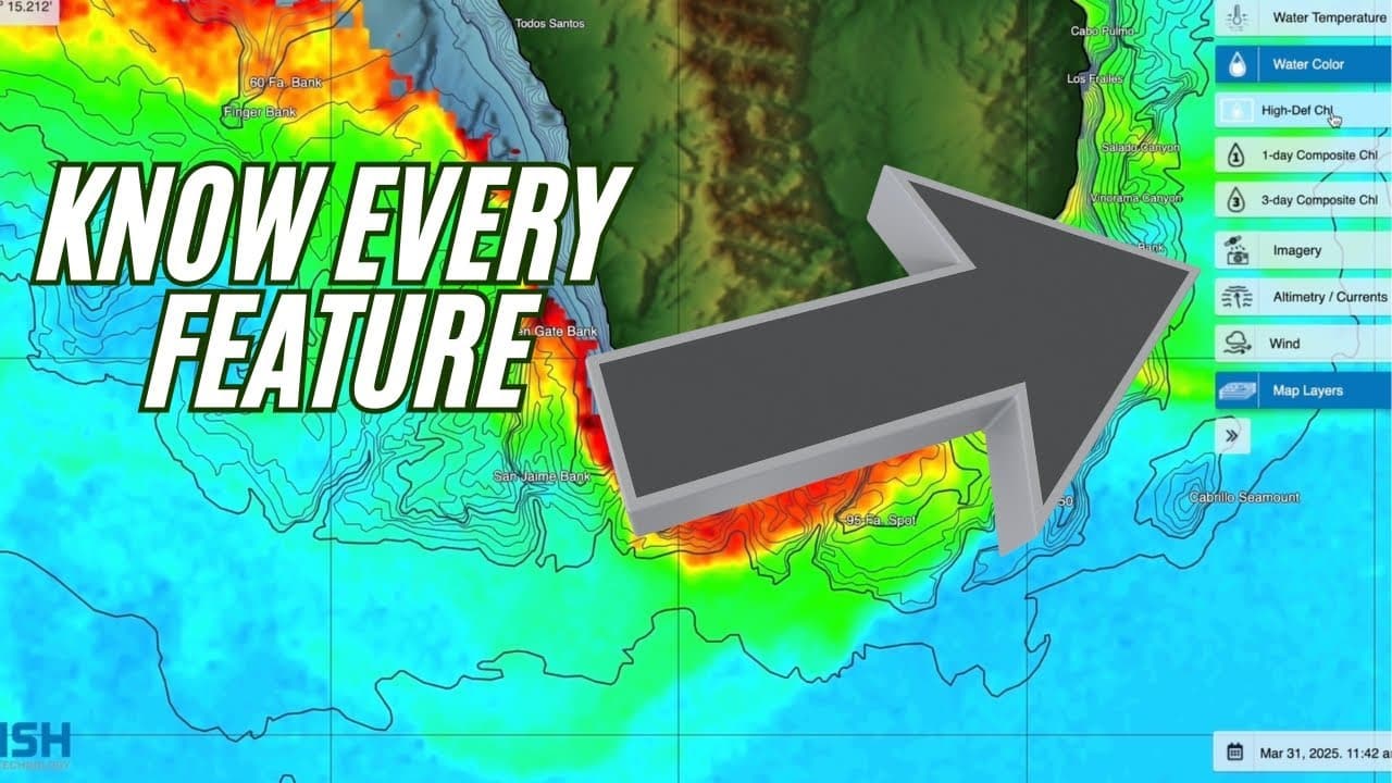
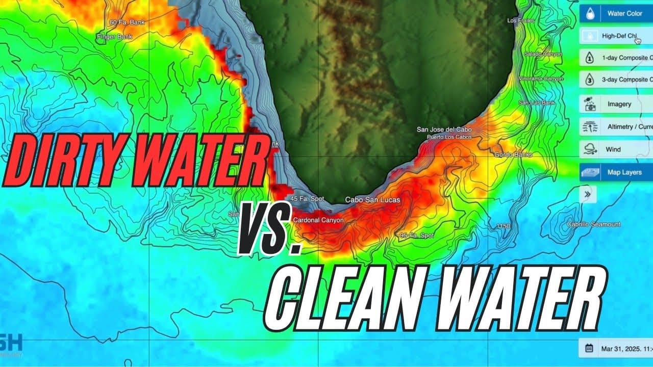
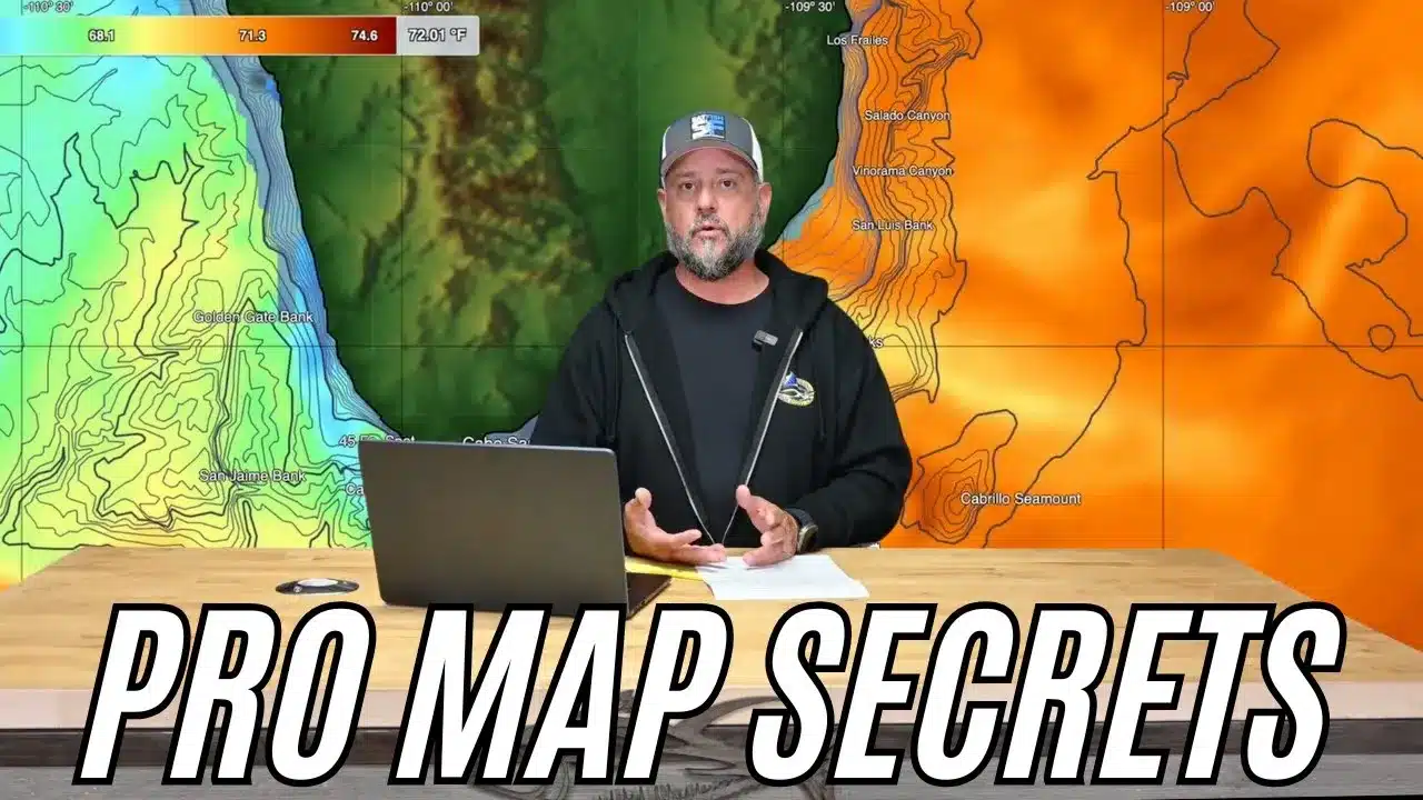
In this detailed SatFish tutorial, Captain Ali Hussainy from Local Knowledge breaks down exactly how to interpret Sea Surface Temperature (SST) and Chlorophyll maps to locate productive offshore fishing zones. Learn the differences between High-Definition SST, 3-day Composite SST, and the Cloud-Free SST charts, and understand when to use each to maximize your fishing trips…. READ MORE
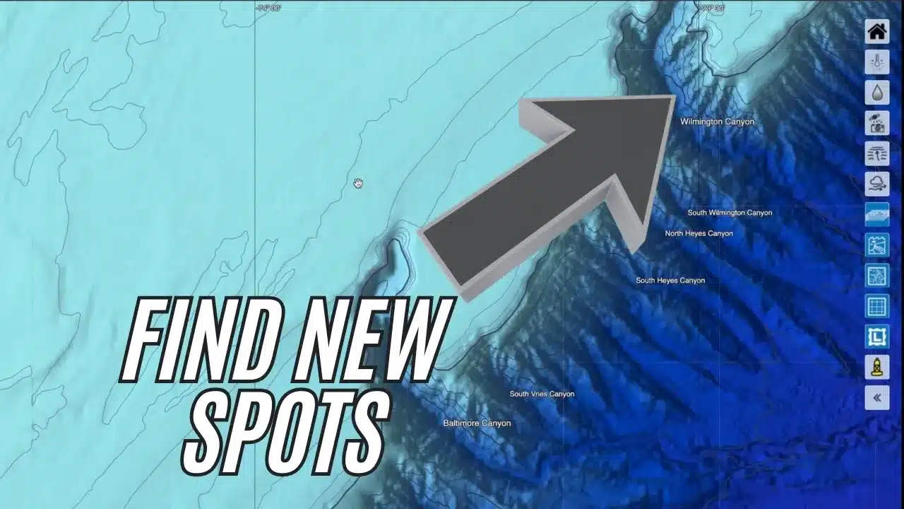
Discover how to maximize your offshore fishing success by mastering the SatFish map interface. In this easy-to-follow tutorial, you’ll learn how to utilize detailed base maps, bathymetric contours, labeled fishing hotspots, latitude-longitude grids, and real-time National Weather Service buoy data directly integrated into SatFish. Whether you’re fishing your local waters or exploring new offshore regions,… READ MORE
Join Captain Ali Hussainy from Local Knowledge as he reveals his essential offshore fishing tool—SatFish, the ultimate “know-before-you-go” mapping software and app designed specifically for anglers. In this video, Ali demonstrates how SatFish’s ultra-high-resolution sea surface temperature (SST) and chlorophyll maps help pinpoint productive fishing areas before you even leave the dock. Learn how interpreting… READ MORE