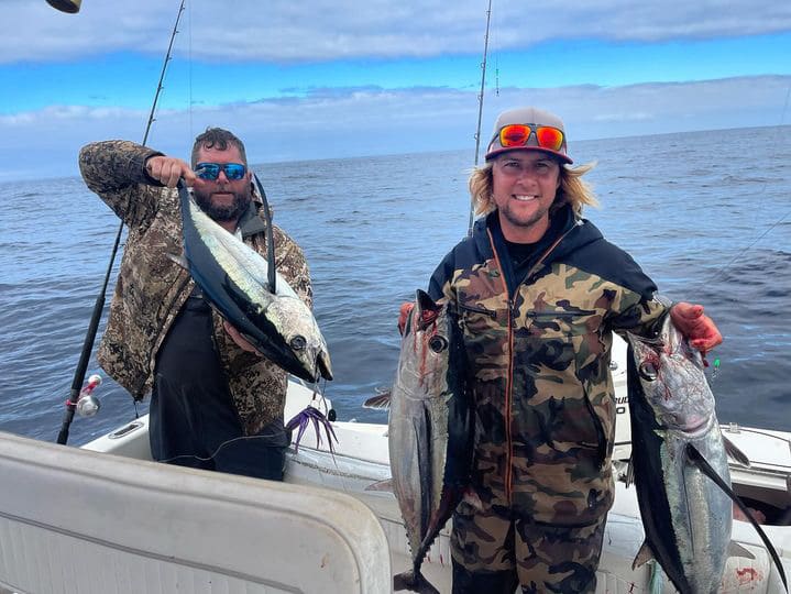
SatFish’s Pacific Northwest offshore fishing maps show you the offshore sea surface temperature (SST) and water color (chlorophyll) breaks vital for finding and catching albacore. Even when it’s cloudy, our cloud-free SST and 1- and 3-day composites will still point you to the right general area to look for life and tuna. Plus, our 5-day wind forecast helps you pick out the right window to make your run offshore.
PacNW Regions We Cover
Pacific Northwest Overview
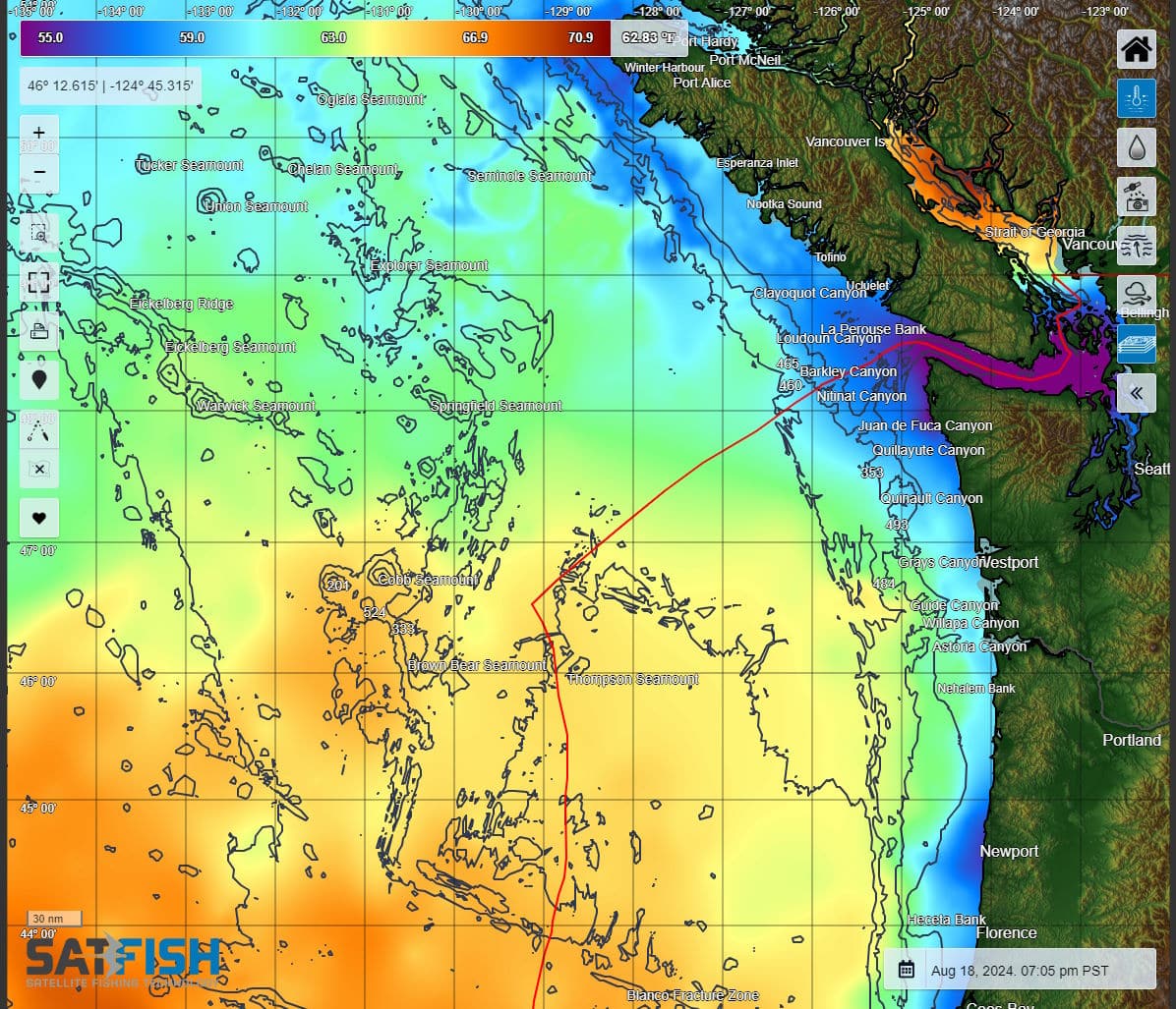
Our Pacific Northwest Overview charts give you a “big picture” overview of the offshore grounds from Vancouver Island to Northern California and offshore to 135W longitude. This is a great map to track the albacore migration route from the middle of the Pacific as they start to arrive to the local grounds.
Haida Gwaii
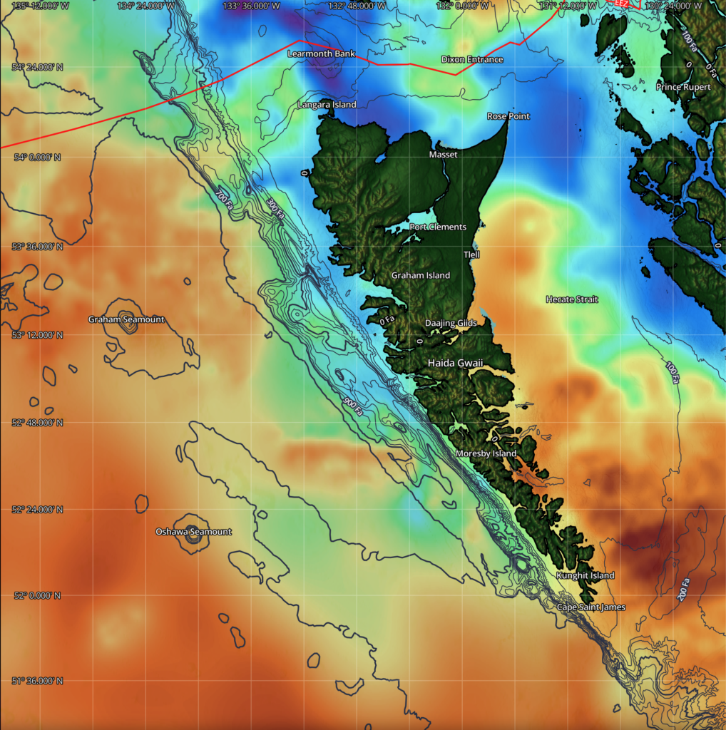
SatFish’s Haida Gwaii fishing chart provides extensive coverage of the region’s inshore and offshore waters, giving recreational anglers, fishing lodges, guides, and charter captains the tools they need to explore new fishing grounds and make better decisions before leaving the dock. Whether you’re targeting salmon along productive current lines or searching deep structure for halibut, lingcod, and rockfish, this map is for you.
Click here to read more about SatFish’s Haida Gwaii Fishing Maps
Vancouver Island
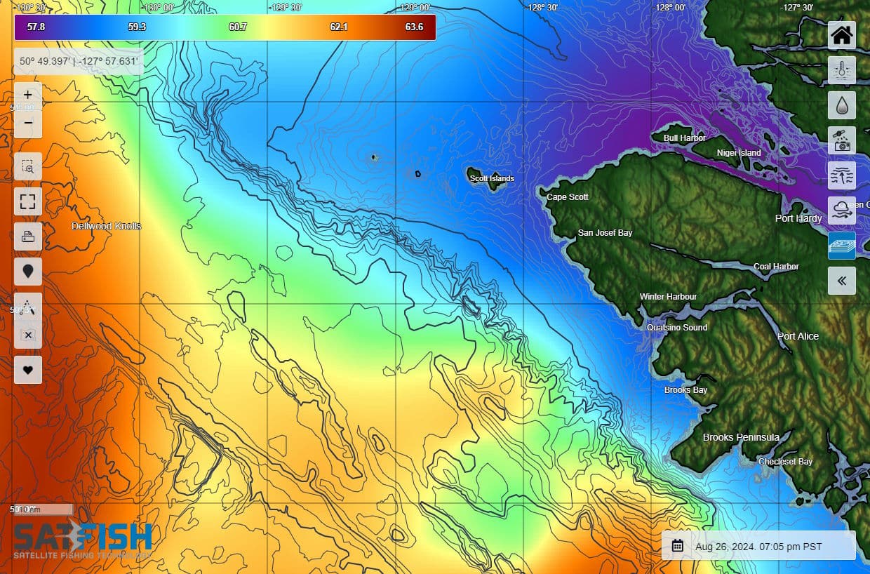

Our Vancouver Island charts cover the main fishing grounds for albacore off Vancouver Island. We have a northern Vancouver Island region for offshore fishing from Winter Harbour and Port Hardy, and a southern region that covers waters accessible from Esperanza Inlet, Nootka Sound, Tofino, and Ucluelet / Barkley Sound.
Click here to read more about Vancouver Island Fishing Charts
Washington
Our Washington fishing chart covers the entire state of Washington and the northern part of Oregon to provide complete coverage of the offshore grounds from Neah Bay and La Push to Westport and Ilwaco.
Westport / Ilwaco
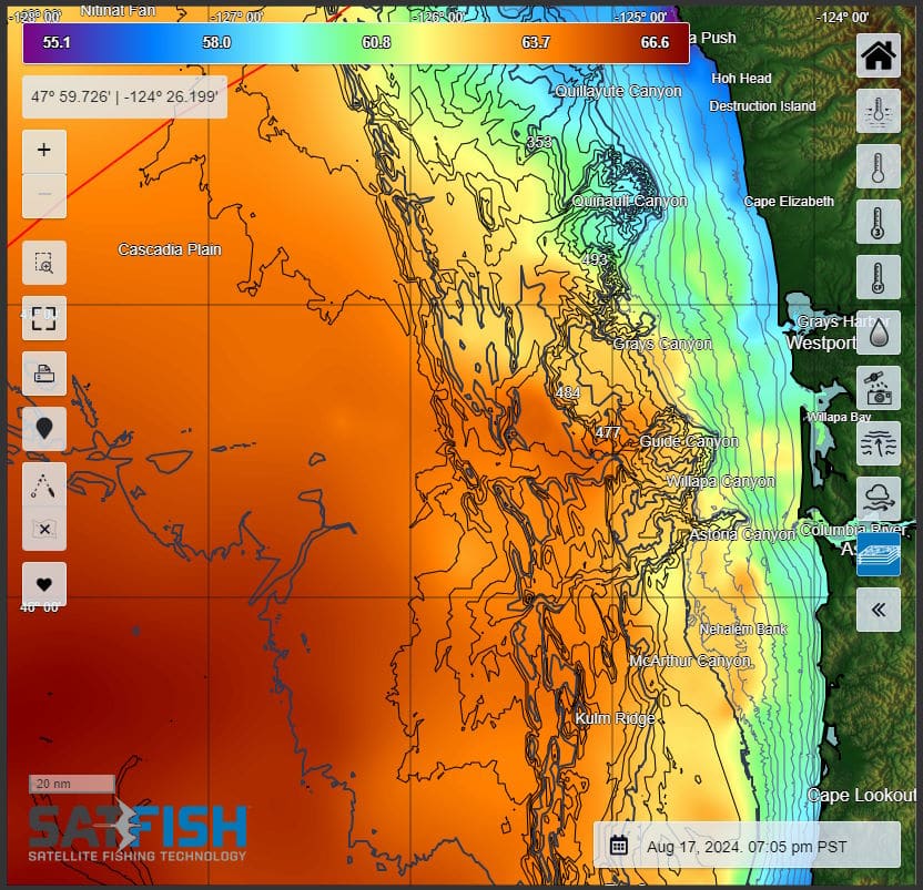
With Westport and Ilwaco being such important ports for albacore fishing, we made a dedicated chart centered on these two ports to provide full coverage of the offshore grounds both north and south of Grays Harbor and the Columbia River.
Click here to read more about Westport and Ilwaco fishing maps
Oregon
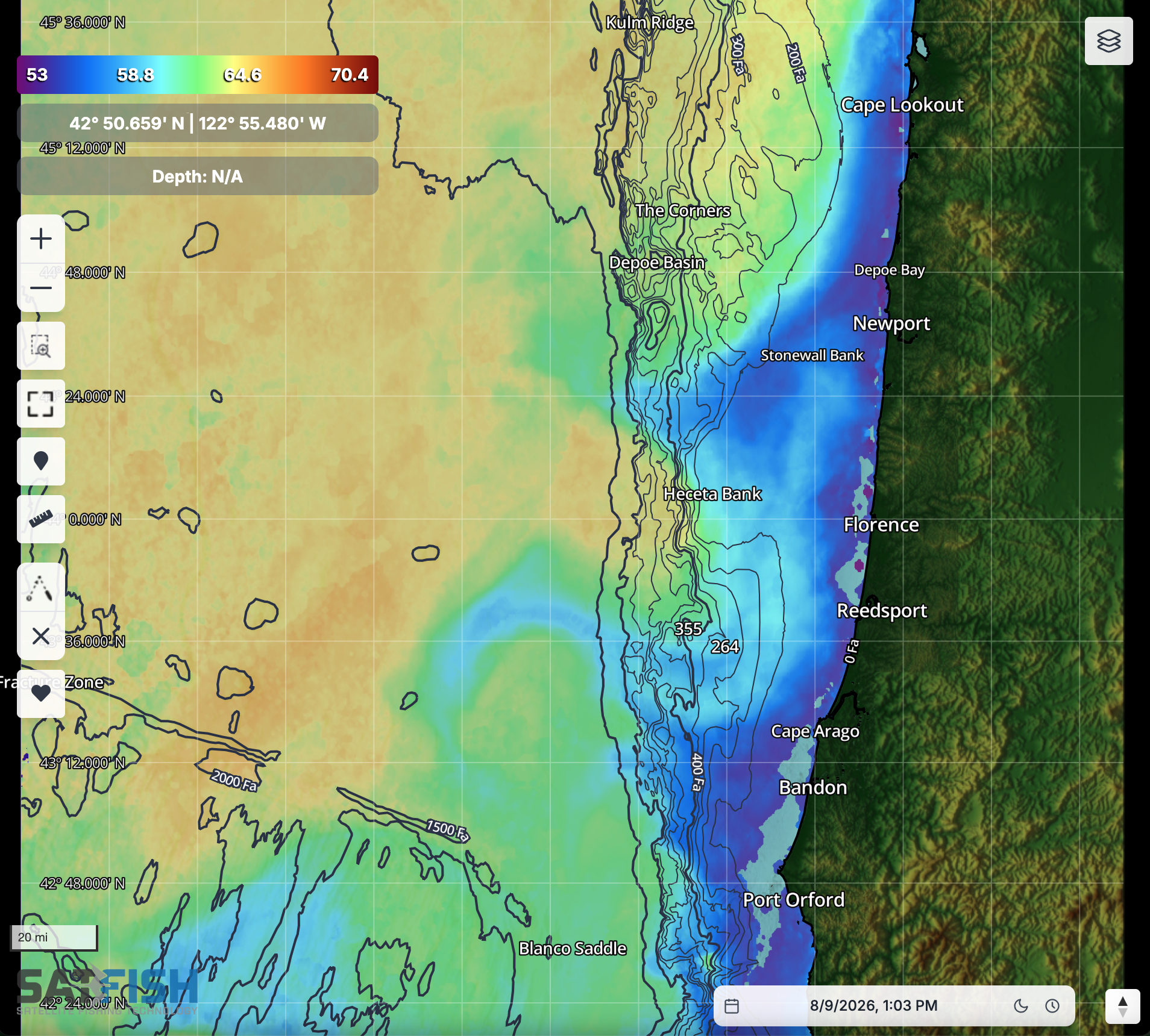
Our Oregon fishing chart covers the entire state of Oregon, from the Columbia River down to northern California. We provide complete coverage of the offshore grounds reachable from Depoe Bay and Newport all the way down through Coos Bay, Bandon, and Port Orford to Brookings.
Southern Oregon / Northern California
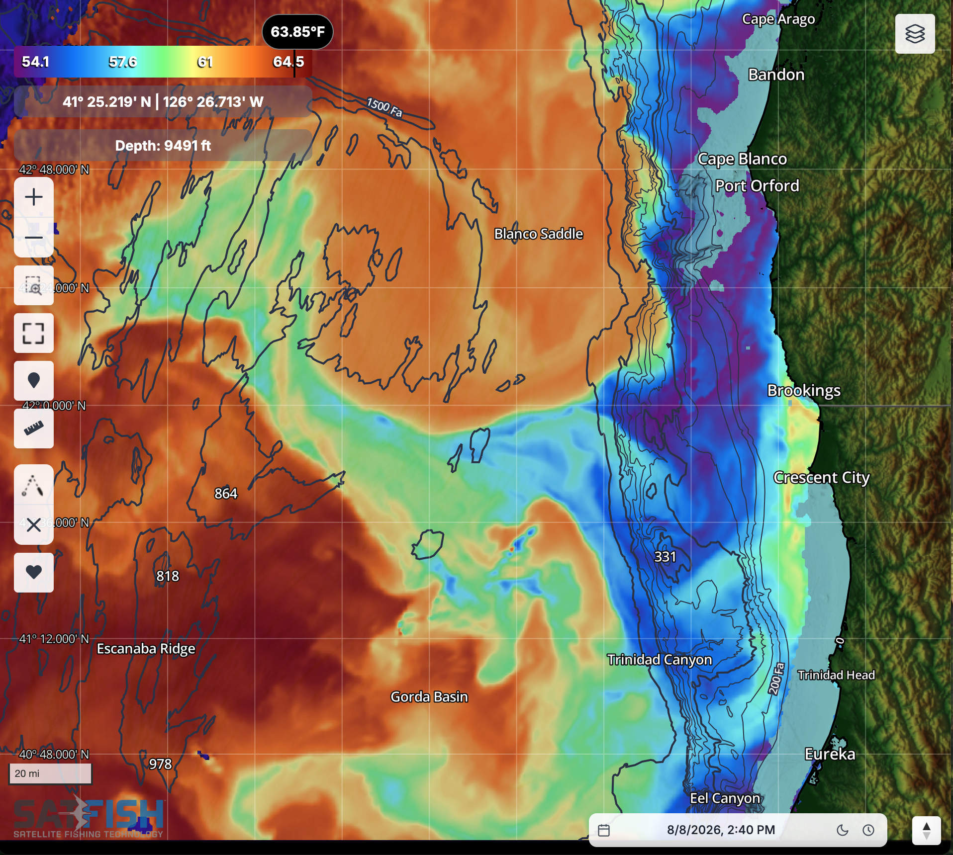
For those of you fishing out of Port Orford, Brookings, and Crescent City, SatFish has you covered! We offer a fishing chart straddling the Oregon – California border to provide full coverage of the offshore grounds, from Bandon to Eureka, so you don’t need to switch back and forth between the Oregon and Northern California charts to decide whether to turn right or left out of the harbor.
Click here to read more about Southern Oregon / Northern California fishing maps
Frequently Asked Questions
What are Pacific Northwest offshore fishing maps used for?
These maps help you find offshore temp breaks (SST) and water-color edges (chlorophyll) that often hold albacore. They’re designed to point you toward the most productive zones before you burn fuel searching.
How do SST and chlorophyll maps help you find albacore?
Albacore commonly relate to cool, clean offshore water and the edges where conditions change fast. High-def SST and chlorophyll breaks make it easier to identify those “tuna lanes” and focus your run.
What if it’s cloudy? Can I still use the maps?
Yes, cloud-free SST and 1-day / 3-day composite layers are built for overcast conditions when regular SST shots are limited. Even if details are smoother, they can still guide you to the right general area to start looking for life and tuna.
How do I choose the best day to run offshore in the Pacific Northwest?
Use the 5-day wind forecast to find a safer, more comfortable weather window for your crew and boat. Planning around wind helps you avoid rough seas and pick the best time to make your offshore run.
Which Pacific Northwest regions does SatFish cover?
Coverage includes areas like Vancouver Island, Washington, and Oregon, plus sub-regions such as Westport/Ilwaco and Southern California / Northern California. That makes it easier to match your home port to the closest offshore chart.
Where can I learn how to read these tuna fishing maps?
The Pacific Northwest section includes blog articles and how-to guides focused on using SST and chlorophyll to find albacore. These walk through practical steps, like identifying breaks, checking composites, and narrowing down your starting zone.
Pacific NW Fishing Tips and Tricks from our Blog
-

Find More Tuna Using Satellite Maps | D&D Fishing Co.
Ever wonder how offshore anglers consistently find tuna before leaving the dock? In this video, we break down exactly how we use temperature maps and…
-

How to Catch Albacore Using SatFish Charts
Albacore prefer cool, clean offshore waters. SatFish high-def SST and Chlorophyll maps show you exactly where to look for these speedy, tasty white-meat tuna.