Satellite Fishing Maps & Charts | SatFish

Satellite Fishing Maps & Charts | SatFish

  • Map Features
    • Sea Surface Temperature Charts
    • Unfiltered (Raw) SST Charts
    • Cloud Free SST Charts
    • Chlorophyll Concentration Maps
    • Wind Forecasts
    • Fishing Hot Spots
    • Mobile Apps
    • Reviews & Testimonials
    • Ambassadors
  • Regions
    • Atlantic Fishing Maps
      • Gulf of Maine
      • Cape Cod / Georges Bank
      • Northeast Canyons
      • North Carolina / Outer Banks
      • South Carolina
      • Georgia
      • Florida
        • Jacksonville
        • East Central Florida
        • Miami
        • Florida Keys
      • Bahamas
      • Bermuda
    • Gulf Of America (Mexico)
      • Texas Coast
      • Louisiana
      • Florida Gulf Coast
        • Destin / FL Panhandle
        • Cape Coral / Fort Myers
        • Tampa / Middle Grounds
    • Mexico Fishing Maps
      • Baja California
        • Ensenada
        • Cedros Island
        • Magdalena Bay
        • Cabo San Lucas / East Cape
        • San Felipe
        • Bahia de Los Angeles
        • Santa Rosalia / Mulege
        • Loreto
        • La Paz
      • Puerto Vallarta
      • Manzanillo
      • Acapulco
      • Puerto Escondido / Salina Cruz
    • Central America / Caribbean
      • Turks and Caicos
      • Caribbean Overview
        • Jamaica
        • Puerto Rico
        • Leeward Islands
        • Windward Islands
      • Guatemala / El Salvador / Nicaragua
      • Costa Rica / Panama
    • West Coast Fishing Maps
      • Pacific Northwest
        • Haida Gwaii
        • Vancouver Island
        • Washington
        • Westport / Ilwaco
        • Oregon
        • Southern Oregon / Northern California
      • Northern California
      • Central California
      • Southern California
      • Hawaii
        • Kauai
        • Oahu
        • Maui
        • Big Island
  • Species
    • Albacore
    • Bigeye Tuna
    • Bluefin Tuna (Atlantic)
    • Bluefin Tuna (Pacific)
    • Blue Marlin
    • Mahi-Mahi
    • Sailfish
    • Striped Marlin
    • Wahoo
    • White Marlin
    • Yellowfin Tuna
  • How-to
    • How-to Videos
    • Getting Started with SatFish
    • How to Use SST & Chloro Charts
    • How to Catch Wahoo
    • How to Catch Dolphin
    • How to Catch Cobia
    • How to Catch Albacore
    • Frequently Asked Questions
  • Blog
  • Free Trial
  • Log In
☰
Satellite Fishing Maps & Charts | SatFish
×
  • Map Features
    • Sea Surface Temperature Charts
    • Unfiltered (Raw) SST Charts
    • Cloud Free SST Charts
    • Chlorophyll Concentration Maps
    • Wind Forecasts
    • Fishing Hot Spots
    • Mobile Apps
    • Reviews & Testimonials
    • Ambassadors
  • Regions
    • Atlantic Fishing Maps
      • Gulf of Maine
      • Cape Cod / Georges Bank
      • Northeast Canyons
      • North Carolina / Outer Banks
      • South Carolina
      • Georgia
      • Florida
        • Jacksonville
        • East Central Florida
        • Miami
        • Florida Keys
      • Bahamas
      • Bermuda
    • Gulf Of America (Mexico)
      • Texas Coast
      • Louisiana
      • Florida Gulf Coast
        • Destin / FL Panhandle
        • Cape Coral / Fort Myers
        • Tampa / Middle Grounds
    • Mexico Fishing Maps
      • Baja California
        • Ensenada
        • Cedros Island
        • Magdalena Bay
        • Cabo San Lucas / East Cape
        • San Felipe
        • Bahia de Los Angeles
        • Santa Rosalia / Mulege
        • Loreto
        • La Paz
      • Puerto Vallarta
      • Manzanillo
      • Acapulco
      • Puerto Escondido / Salina Cruz
    • Central America / Caribbean
      • Turks and Caicos
      • Caribbean Overview
        • Jamaica
        • Puerto Rico
        • Leeward Islands
        • Windward Islands
      • Guatemala / El Salvador / Nicaragua
      • Costa Rica / Panama
    • West Coast Fishing Maps
      • Pacific Northwest
        • Haida Gwaii
        • Vancouver Island
        • Washington
        • Westport / Ilwaco
        • Oregon
        • Southern Oregon / Northern California
      • Northern California
      • Central California
      • Southern California
      • Hawaii
        • Kauai
        • Oahu
        • Maui
        • Big Island
  • Species
    • Albacore
    • Bigeye Tuna
    • Bluefin Tuna (Atlantic)
    • Bluefin Tuna (Pacific)
    • Blue Marlin
    • Mahi-Mahi
    • Sailfish
    • Striped Marlin
    • Wahoo
    • White Marlin
    • Yellowfin Tuna
  • How-to
    • How-to Videos
    • Getting Started with SatFish
    • How to Use SST & Chloro Charts
    • How to Catch Wahoo
    • How to Catch Dolphin
    • How to Catch Cobia
    • How to Catch Albacore
    • Frequently Asked Questions
  • Blog
  • Free Trial
  • Log In
Built By Fishermen For Fishermen
Sign up now for a FREE 30-day trial!
Free Trial

Capt. Mike “Slick” Dupree
X-Rayted Fishing


Captain Mike “Slick” Dupree is a North Carolina native. He is an avid outdoorsman and youth mentor. Slick grew up hunting and fishing all over the state of NC, from farm ponds to bass tournaments, inshore redfish tournaments to king mackerel and in recent years, blue marlin tournaments. Slick has also guided deer, duck and turkey hunts on public land. He eventually made his way offshore running charters and commercial fishing for pelagics and in most recent years, has honed in on slow trolling for Wahoo. Well known for North Carolina wahoo fishing, Slick is the owner/operator of “X-Rayted Fishing Team” out of Harkers Island, NC.
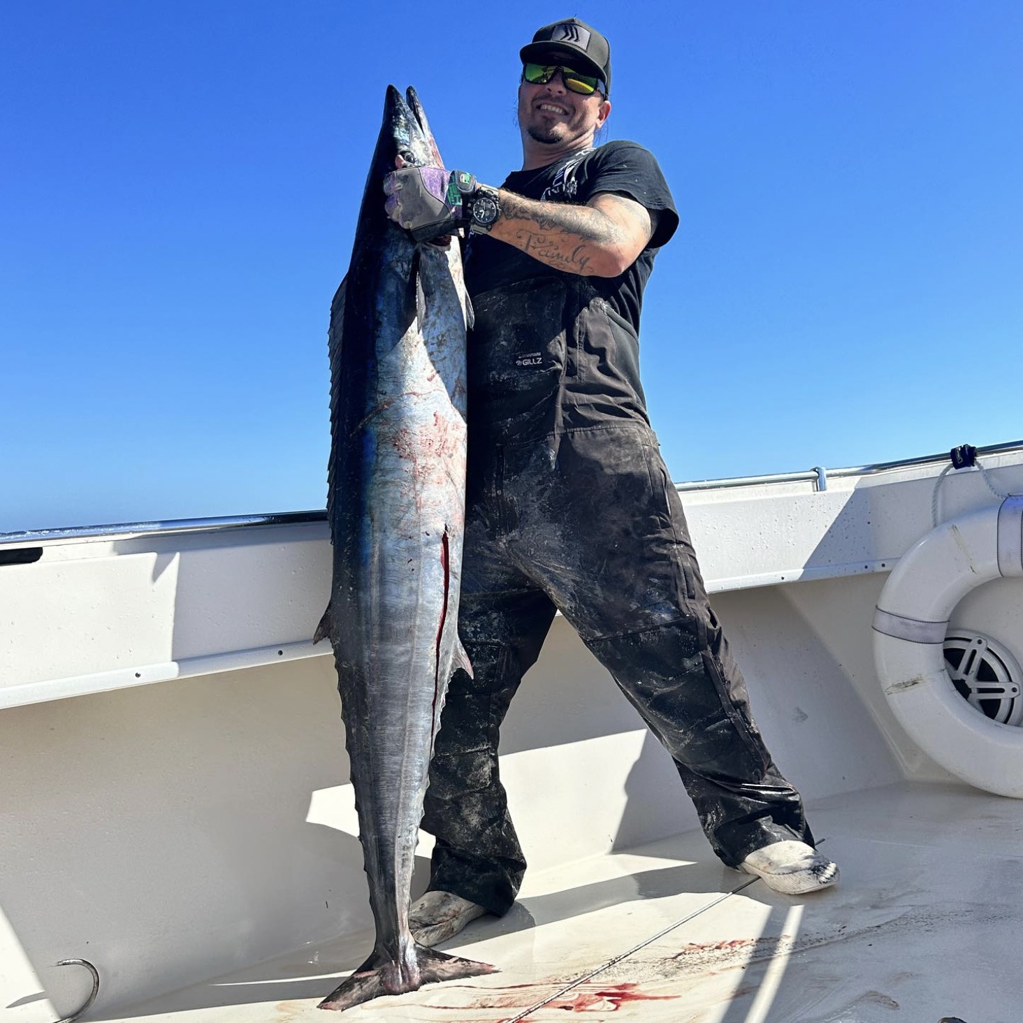
Captain Mike Dupree holding a wahoo

“I’m often asked; with all of the SST/Wind/Current charts & Services, what is my go to? Without hesitation, I tell them SatFish. SatFish is the very first thing I check before heading offshore. It provides every key detail I need in order to make my synopsis for a day’s fishing. From currents to chlorophyll concentration, wind and sea surface temps, altimetry, and so on. SatFish is hands down the number one weapon in my arsenal and I never leave the docks without it.”

– Capt. Mike “Slick” Dupree

Connect with Capt. Slick:

Instagram: @slicksnsticks
Instagram: @x_rayted_fishing_team
FB: Mike “Slick” Dupree
FB: X Rayted Fishing Team
YouTube: Slick Moves
Website: www.xraytedfishing.com


Share:

Primary Sidebar

Recent Posts

SatFish Blog

Recent Posts

Thunderbolt Wreck Marathon Fishing Guide: SatFish Maps & Wahoo Game Plan

Mahi Madness! How to Find and Catch More Mahi | Marathon Sportfishing

Up, Down, and All Around: Sea Surface Altimetry and Why It Matters

Your Membership Includes:

Your Membership Includes:

  • ✓ Full access to all regions
  • ✓ Detailed bathymetry maps
  • ✓ Depth contours
  • ✓ Fishing hot spots
  • ✓ Fishing closures and political boundaries (where available)
  • ✓ Custom detailed route planning
  • ✓ FREE mobile app for iOS and Android devices
 

Sea Surface Temperatures:

  • ✓ High-Res Sea Surface Temperature (SST) Charts (6-8 images/day)
  • ✓ Cloud-Free SST (1 image/day)
  • ✓ 3-Day Composite SST (1 image/day)
 

Water Color:

  • ✓ High-res Chlorophyll Charts (2-3 images/day)
  • ✓ 1-Day Composite Chlorophyll (1 image/day)
  • ✓ 3-Day Composite Chlorophyll (1 image/day)
 

Imagery:

  • ✓ ENHANCED True Color Satellite Imagery (1-3 images/day)
 

Satellite Altimetry:

  • ✓ Sea Surface Height (1 image/day)
  • ✓ Surface Currents Map (1 image/day)
 

Marine Weather:

  • ✓ Real-time weather buoy data (updated every ~1 hour)
  • ✓ 5-Day Wind Forecast (updated 4x/day)
Free 30 Day Trial

Footer

Start A FREE

30-Day Trial!

Join today for a FREE 30-day trial!

Only $129 per year

Free Trial
logo
© 2024 SatFish. All Rights Reserved.
  • My Account
  • Contact
  • Technical Support
  • Terms
  • Privacy Policy