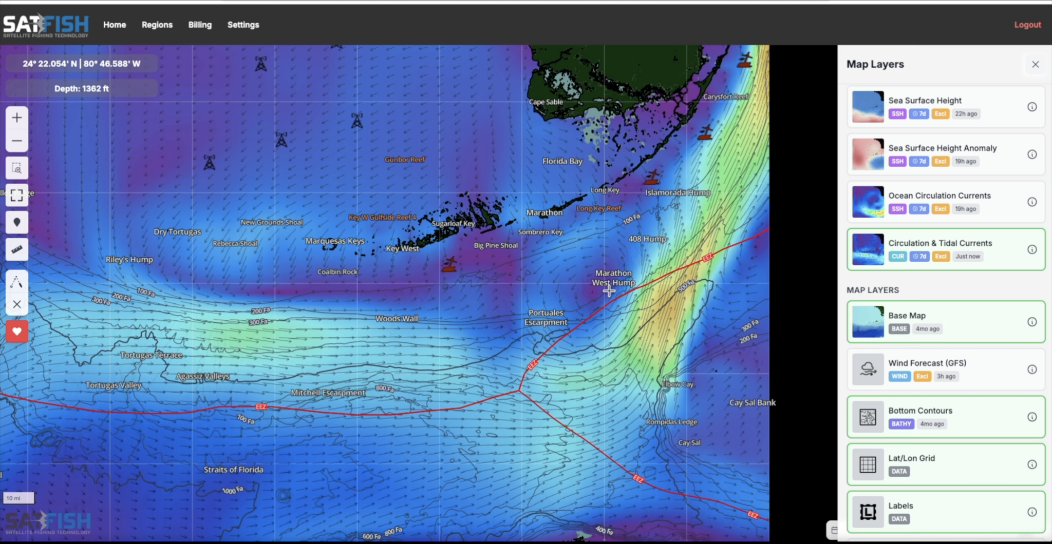
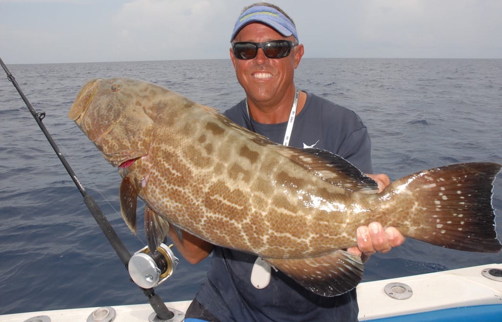
SatFish’s Florida fishing maps have all the temperature, water color, ocean currents, and bathymetry / bottom structure maps Florida anglers need to find and catch sailfish, wahoo, kingfish, tuna, dolphin, marlin, swordfish, and more. Our daily high-definition water temperature maps show every eddy and finger of the Gulf Stream in incredible detail, and with daily updated currents, you’ll know exactly when that warm, clean water is pushing in to your favorite ledge, wreck, or reef edge.
Florida Regions We Cover
Florida Overview
The Florida Overview fishing chart gives a great big-picture view of the entire state and the Gulf Stream as it jets out from the Gulf of Mexico and up the east coast. For a more zoomed-in view with better detail on the bottom structure, check out one of our maps below.
Jacksonville
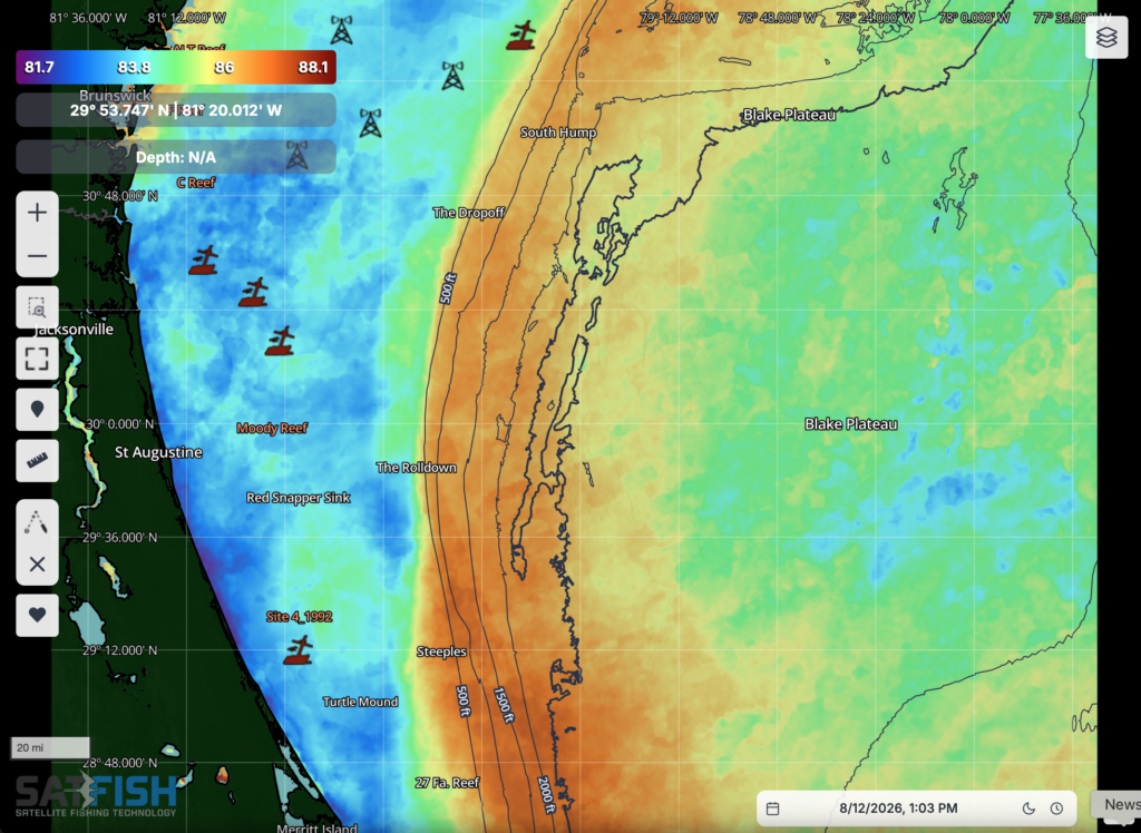
The SatFish Florida – Jacksonville chart covers the greater Jacksonville region from the Georgia border to the north part of Cape Canaveral.
Click here to learn more about SatFish’s Jacksonville Offshore Fishing Maps
East Central Florida
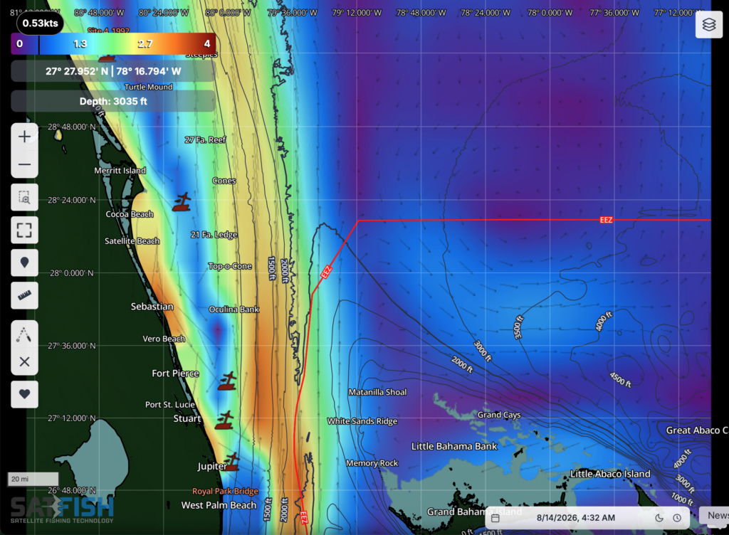
Our East Central Florida fishing map shows Cape Canaveral and the inshore and offshore grounds for Satellite Beach, Sebastian, Stuart, and Jupiter Inlet. The map covers all the way out past the 120-mile Canaveral East buoy and Grand Bahama, so you get a full picture of the eastern edge of the Gulf Stream for tracking down yellowfin tuna and marlin.
Click here to learn more about SatFish’s East Central Florida Offshore Fishing Maps
Miami
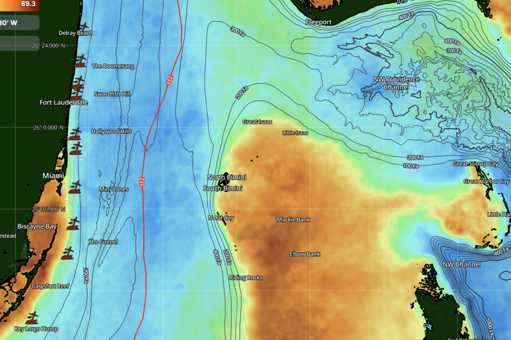
The SatFish Florida – Miami fishing chart covers Miami and Bimini out to Andros Island, from Palm Beach and Ft. Lauderdale down to the Islamorada area in the upper Keys.
Click here to learn more about SatFish’s Miami Offshore Fishing Maps
Florida Keys
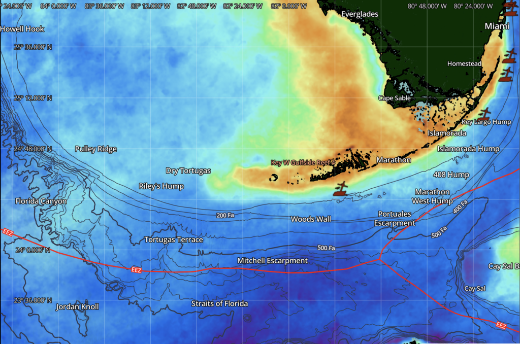
SatFish’s Florida Keys fishing map shows all the great fishing grounds through the entire length of the Keys, from Key Largo and Islamorada all the way down through Marathon and Key West to the Marquesas, Dry Tortugas, and even out to Pulley Ridge.
Click here to learn more about StaFish’s Florida Keys Offshore Fishing Maps
Cape Coral

The SatFish Cape Coral / Fort Myers fishing chart shows the Florida Gulf Coast from Venice down to the Everglades. The map extends all the way out to the Florida Escarpment and Howell Hook to give you a full view of all the grouper and snapper grounds on the shelf and dropoff.
Click here to learn more about SatFish’s Cape Coral / Fort Myers Offshore Fishing Maps
Tampa / Middle Grounds
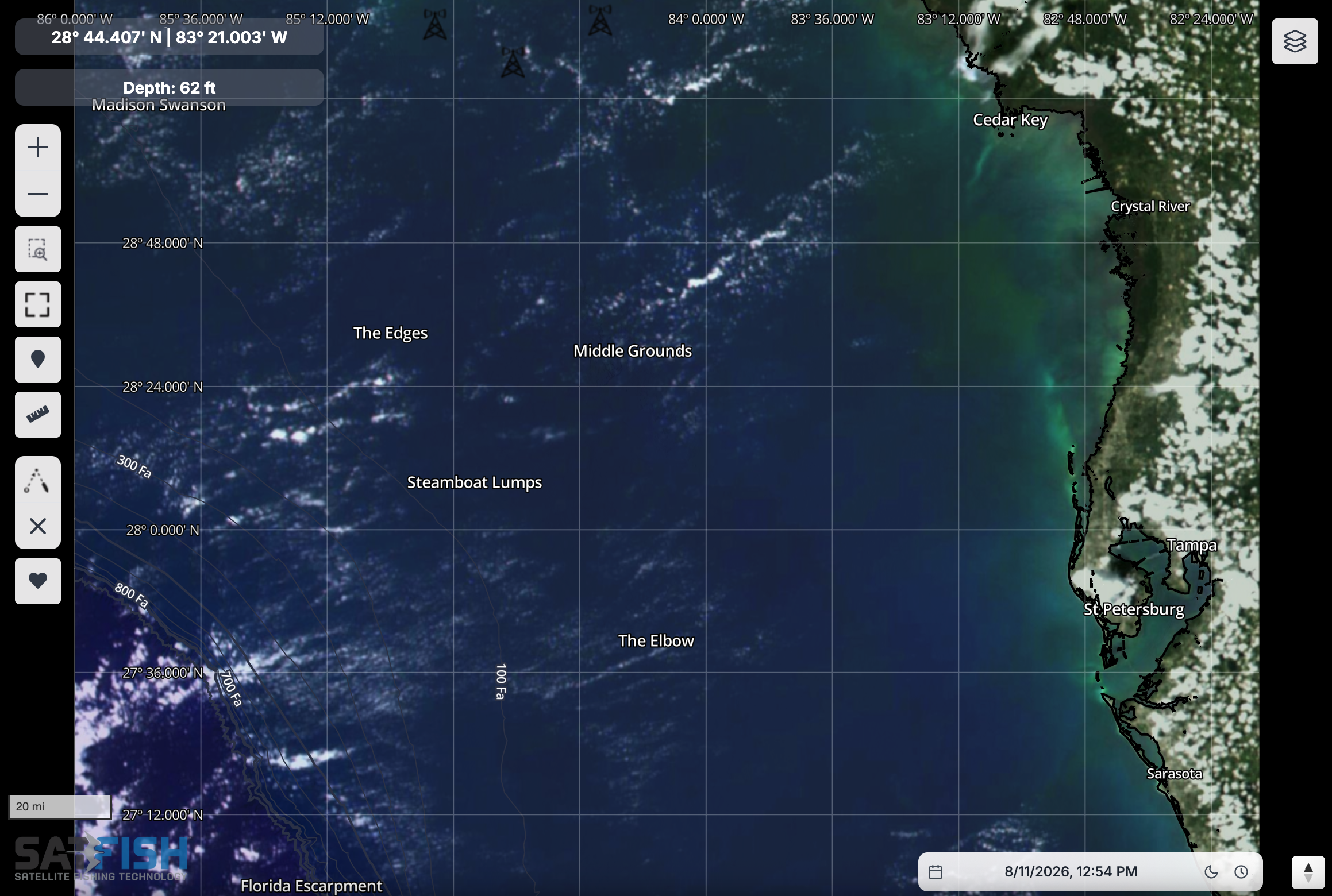
The SatFish Tampa / Florida Middle Grounds fishing map covers the entire Florida Gulf Coast around the greater Tampa Bay area from Cedar Key to Sarasota and Venice. The map shows all the way west well past the Florida Middle Grounds, out to the Florida Escarpment to provide full coverage of all the legendary bottom fishing hot spots in the region.
Click here to learn more about SatFish’s Tampa / Florida Middle Grounds Offshore Fishing Maps
Destin / Panhandle
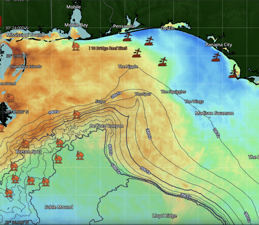
Our Destin / Florida Panhandle fishing map shows the inshore and offshore fishing spots reachable from Destin, Pensacola, and Panama City, including DeSoto Canyon and all the way down to the Florida Middle Grounds.
Click here to read more about SatFish’s Destin / Florida Panhandle Offshore Fishing Maps
Frequently Asked Questions
What are SatFish Florida fishing maps used for?
SatFish Florida maps combine SST (sea surface temperature), chlorophyll (water color), ocean currents, and bathymetry to help you find productive offshore water. They’re designed to help you locate feeding zones faster and avoid empty, lifeless water.
Which fish species can these maps help me target in Florida?
Florida anglers commonly use these maps to find sailfish, wahoo, kingfish, tuna, dolphin (mahi), marlin, and swordfish. The key is matching the right conditions, temp breaks, clean/green edges, and current flow, to your target species.
How do the maps help me read the Gulf Stream in Florida?
High-definition SST can show fine details like eddies and “fingers” of the Gulf Stream. When you pair SST with daily current updates, you can see when warm, clean water is pushing toward ledges, wrecks, or reef edges.
What Florida regions does SatFish cover?
Coverage includes Florida Overview plus regions like Jacksonville, East Central Florida, Miami, the Florida Keys, Cape Coral, Tampa / Middle Grounds, and Destin / the Panhandle. This helps you select the right chart for your home port and fishing grounds.
How should I use SST, chlorophyll, and currents together offshore?
Start by finding strong temperature breaks and water-color edges, then check currents to see where the flow is concentrating bait. When these features overlap near structure, it often signals a higher-probability zone to troll, drift, or chum.
Where can I learn Florida-specific tactics for using SatFish maps?
The Florida section includes blog articles and how-to guides on topics like wahoo in the Keys, blackfin tactics, and mahi strategies. These posts show practical ways to interpret SST, chlorophyll, and current charts before and during your trip.