Satellite Fishing Maps & Charts | SatFish

Satellite Fishing Maps & Charts | SatFish

  • Map Features
    • Sea Surface Temperature Charts
    • Unfiltered (Raw) SST Charts
    • Cloud Free SST Charts
    • Chlorophyll Concentration Maps
    • Wind Forecasts
    • Fishing Hot Spots
    • Mobile Apps
    • Reviews & Testimonials
    • Ambassadors
  • Regions
    • Atlantic Fishing Maps
      • Gulf of Maine
      • Cape Cod / Georges Bank
      • Northeast Canyons
      • North Carolina / Outer Banks
      • South Carolina
      • Georgia
      • Florida
        • Jacksonville
        • East Central Florida
        • Miami
        • Florida Keys
      • Bermuda
      • Bahamas
    • Gulf Of America (Mexico)
      • Texas Coast
      • Louisiana
      • Florida Gulf Coast
        • Destin / FL Panhandle
        • Cape Coral / Fort Myers
        • Tampa / Middle Grounds
    • Mexico Fishing Maps
      • Baja California
        • Ensenada
        • Cedros Island
        • Magdalena Bay
        • Cabo San Lucas / East Cape
        • San Felipe
        • Bahia de Los Angeles
        • Santa Rosalia / Mulege
        • Loreto
        • La Paz
      • Puerto Vallarta
      • Manzanillo
      • Acapulco
      • Puerto Escondido / Salina Cruz
    • Central America / Caribbean
      • Turks and Caicos
      • Caribbean Overview
        • Jamaica
        • Puerto Rico
        • Leeward Islands
        • Windward Islands
      • Guatemala / El Salvador / Nicaragua
      • Costa Rica / Panama
    • West Coast Fishing Maps
      • Pacific Northwest
        • Haida Gwaii
        • Vancouver Island
        • Washington
        • Westport / Ilwaco
        • Oregon
        • Southern Oregon / Northern California
      • Northern California
      • Central California
      • Southern California
      • Hawaii
        • Kauai
        • Oahu
        • Maui
        • Big Island
  • Species
    • Albacore
    • Bigeye Tuna
    • Bluefin Tuna (Atlantic)
    • Bluefin Tuna (Pacific)
    • Blue Marlin
    • Mahi-Mahi
    • Sailfish
    • Striped Marlin
    • Wahoo
    • White Marlin
    • Yellowfin Tuna
  • How-to
    • How-to Videos
    • Getting Started with SatFish
    • How to Use SST & Chloro Charts
    • How to Catch Wahoo
    • How to Catch Dolphin
    • How to Catch Cobia
    • How to Catch Albacore
    • Frequently Asked Questions
  • Blog
  • Free Trial
  • Log In
☰
Satellite Fishing Maps & Charts | SatFish
×
  • Map Features
    • Sea Surface Temperature Charts
    • Unfiltered (Raw) SST Charts
    • Cloud Free SST Charts
    • Chlorophyll Concentration Maps
    • Wind Forecasts
    • Fishing Hot Spots
    • Mobile Apps
    • Reviews & Testimonials
    • Ambassadors
  • Regions
    • Atlantic Fishing Maps
      • Gulf of Maine
      • Cape Cod / Georges Bank
      • Northeast Canyons
      • North Carolina / Outer Banks
      • South Carolina
      • Georgia
      • Florida
        • Jacksonville
        • East Central Florida
        • Miami
        • Florida Keys
      • Bermuda
      • Bahamas
    • Gulf Of America (Mexico)
      • Texas Coast
      • Louisiana
      • Florida Gulf Coast
        • Destin / FL Panhandle
        • Cape Coral / Fort Myers
        • Tampa / Middle Grounds
    • Mexico Fishing Maps
      • Baja California
        • Ensenada
        • Cedros Island
        • Magdalena Bay
        • Cabo San Lucas / East Cape
        • San Felipe
        • Bahia de Los Angeles
        • Santa Rosalia / Mulege
        • Loreto
        • La Paz
      • Puerto Vallarta
      • Manzanillo
      • Acapulco
      • Puerto Escondido / Salina Cruz
    • Central America / Caribbean
      • Turks and Caicos
      • Caribbean Overview
        • Jamaica
        • Puerto Rico
        • Leeward Islands
        • Windward Islands
      • Guatemala / El Salvador / Nicaragua
      • Costa Rica / Panama
    • West Coast Fishing Maps
      • Pacific Northwest
        • Haida Gwaii
        • Vancouver Island
        • Washington
        • Westport / Ilwaco
        • Oregon
        • Southern Oregon / Northern California
      • Northern California
      • Central California
      • Southern California
      • Hawaii
        • Kauai
        • Oahu
        • Maui
        • Big Island
  • Species
    • Albacore
    • Bigeye Tuna
    • Bluefin Tuna (Atlantic)
    • Bluefin Tuna (Pacific)
    • Blue Marlin
    • Mahi-Mahi
    • Sailfish
    • Striped Marlin
    • Wahoo
    • White Marlin
    • Yellowfin Tuna
  • How-to
    • How-to Videos
    • Getting Started with SatFish
    • How to Use SST & Chloro Charts
    • How to Catch Wahoo
    • How to Catch Dolphin
    • How to Catch Cobia
    • How to Catch Albacore
    • Frequently Asked Questions
  • Blog
  • Free Trial
  • Log In
Built By Fishermen For Fishermen
Sign up now for a FREE 30-day trial!
Free Trial
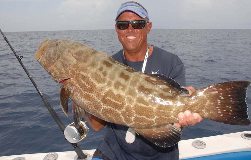
Capt. Ryan Van Fleet from Good Karma Sportfishing in Tavernier, FL with a big black grouper

Capt. Ryan Van Fleet
Good Karma Sportfishing


Captain Ryan Van Fleet is a USCG Captain and the owner Good Karma Sportfishing, a premier sportfishing charter company located in Tavernier, FL.​

Capt. Ryan’s passion is putting his clients on big fish such as mutton snapper, wahoo, flag yellow tail, and black fin tuna, and teaching them how to target these species on their own. He uses SatFish as a crucial tool in finding the productive zones to catch fish. Check out his video where he demonstrates how he uses SatFish to target wahoo in the Florida Keys:

Good Karma Sportfishing also provides online courses, a private fishing group, and 1:1 coaching and consulting, using SatFish charts as a fundamental part of his teaching. ​Capt. Ryan says he chooses SatFish because:

After testing the product, I found it accurate and was excited to share my positive experiences with SATFISH offshore. The SATFISH Offshore service offers a comprehensive guide to finding Florida Keys dolphin and wahoo.

– Capt. Ryan Van Fleet

Capt. Ryan also created The Good Karma Sportfishing Podcast and regularly posts to his blog to help others learn more about sportfishing, and to always remind his readers, “Whenever You’re Fishing – It’s All Good!”​

Connect with Capt. Ryan:​
Good Karma Sportfishing Website​
Good Karma Sportfishing on Instagram

Latest Posts by Capt. Ryan Van Fleet

  • Thunderbolt Wreck Marathon Fishing Guide: SatFish Maps & Wahoo Game PlanSeptember 23, 2026
    This is a wahoo fishing game plan for the Thunderbolt wreck off Marathon. It’s built from the new SatFish HD bathymetry chart (a high-definition map of the ocean floor) below and the daily tide data from the closest NOAA station. The Thunderbolt sits on the 20-fathom (120 ft) line — that’s the exact edge where the reef drops off… READ MORE
  • Captain Ryan Van Fleet of Good Karma Sportfishing seeing great wahoo fishing with his clients
    In-Depth Guide to Finding and Catching Wahoo in the Florida KeysJanuary 31, 2025
    Capt. Ryan Van Fleet of Good Karma Sportfishing shares how he uses SatFish SST, chlorophyll, and currents charts to find wahoo in the Florida Keys.
  • large grouper caught trolling in the Florida Keys
    Using SatFish to Target Grouper in the Florida KeysOctober 18, 2024
    Capt. Ryan Van Fleet shares a few SatFish tips for locating optimal grouper trolling fishing hotspots in the Florida Keys. Find the bait, find the grouper by using SatFish. 
  • two anglers holding a big bull mahi mahi (aka dolphin or dorado) with Capt Ryan Van Fleet in the Florida Keys
    Using SatFish Charts to Target Mahi Mahi During the Summer HeatJune 26, 2024
    Capt. Ryan Van Fleet of Good Karma Sportfishing shares how he uses SatFish SST and Chloro charts to find breaks and weedlines for Florida keys mahi mahi.
Share:

Primary Sidebar

Recent Posts

SatFish Blog

Recent Posts

How Cabo Captains Use SatFish to Find Marlin, Tuna, Dorado, and Wahoo

10 Top Tips for Fall Stripers

Thunderbolt Wreck Marathon Fishing Guide: SatFish Maps & Wahoo Game Plan

Your Membership Includes:

Your Membership Includes:

  • ✓ Full access to all regions
  • ✓ Detailed bathymetry maps
  • ✓ Depth contours
  • ✓ Fishing hot spots
  • ✓ Fishing closures and political boundaries (where available)
  • ✓ Custom detailed route planning
  • ✓ FREE mobile app for iOS and Android devices
 

Sea Surface Temperatures:

  • ✓ High-Res Sea Surface Temperature (SST) Charts (6-8 images/day)
  • ✓ Cloud-Free SST (1 image/day)
  • ✓ 3-Day Composite SST (1 image/day)
 

Water Color:

  • ✓ High-res Chlorophyll Charts (2-3 images/day)
  • ✓ 1-Day Composite Chlorophyll (1 image/day)
  • ✓ 3-Day Composite Chlorophyll (1 image/day)
 

Imagery:

  • ✓ ENHANCED True Color Satellite Imagery (1-3 images/day)
 

Satellite Altimetry:

  • ✓ Sea Surface Height (1 image/day)
  • ✓ Surface Currents Map (1 image/day)
 

Marine Weather:

  • ✓ Real-time weather buoy data (updated every ~1 hour)
  • ✓ 5-Day Wind Forecast (updated 4x/day)
Free 30 Day Trial

Footer

Start A FREE

30-Day Trial!

Join today for a FREE 30-day trial!

Only $129 per year

Free Trial
logo
© 2024 SatFish. All Rights Reserved.
  • My Account
  • Contact
  • Technical Support
  • Terms
  • Privacy Policy