
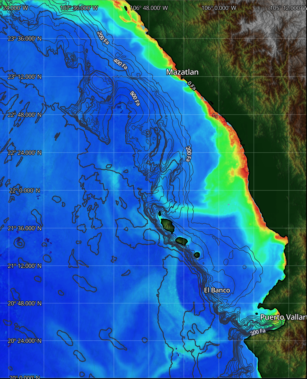
SatFish’s Puerto Vallarta and Mazatlán fishing maps help anglers locate productive offshore water along Mexico’s Pacific coast before leaving the marina. From Banderas Bay, El Banco, and the Marietas Islands to Mazatlán’s offshore banks and deepwater fishing grounds, satellite data can reveal where warm bluewater, bait, current, and structure come together. These conditions create opportunities for yellowfin tuna, blue and striped marlin, sailfish, mahi-mahi, wahoo, roosterfish, and yellowtail throughout the year.
Sea surface temperature maps help identify temperature breaks, warm-water fingers, eddies, and current boundaries that may concentrate pelagic fish. Pair SST with chlorophyll and satellite water-color imagery to locate clean-water edges, blue-green transitions, and productive zones where baitfish gather. Bathymetry maps add another layer by highlighting offshore banks, ledges, drop-offs, and underwater structure around Puerto Vallarta and Mazatlán. Cloud-free imagery and multi-day composites provide useful context when clouds obscure the latest satellite pass.
SatFish helps anglers find productive offshore fishing water near Puerto Vallarta and Mazatlán by combining current SST charts, chlorophyll imagery, water-color data, and bathymetry in one fishing map. These satellite layers reveal temperature breaks, bluewater edges, current boundaries, offshore banks, and bait-holding zones that can attract yellowfin tuna, marlin, sailfish, mahi-mahi, wahoo, and yellowtail along Mexico’s Pacific coast. Before departing from Puerto Vallarta or Mazatlán, anglers can compare changing ocean conditions and select several high-potential fishing areas within their range. Offshore, birds, bait schools, current rips, floating debris, and sonar marks can confirm the most productive water, helping crews adjust their route quickly and spend more time fishing instead of searching.
Frequently Asked Questions
What are the Puerto Vallarta Offshore Fishing Maps used for?
These maps help you spot the temperature (SST) and water color (chlorophyll) breaks that often hold bait and offshore gamefish. They’re designed to help you run to productive water faster and avoid “dead” zones.
Which SatFish layers should I check first before leaving the dock?
Start with High-Res SST and chlorophyll to find the strongest edges and “life zones,” then confirm with cloud-free SST if the sky is overcast. If you’re planning a longer run, add wind forecast and buoy data to pick a safer window.
What should I use when it’s cloudy offshore?
Use Cloud-Free SST plus the 1-day and 3-day composites to maintain coverage when regular satellite shots are limited. These blended layers may look smoother, but they still point you to the best general zone to start hunting.
How do currents and sea surface height help offshore fishing near Puerto Vallarta?
Surface currents and sea surface height (altimetry) can reveal rips, current edges, and zones where water piles up or moves, often concentrating bait. When these features line up with SST or chlorophyll breaks, it can signal a high-probability bite area.
How can bathymetry and depth contours help me find new fishing grounds?
High-resolution bathymetry shows structures like ledges, drop-offs, and bottom texture that can hold bait and predators. Depth contours make it easier to see steep breaks when contour lines tighten up; you’re looking at a sharper drop that can fish well.
Can I use SatFish on the boat with no cell service?
Yes, use the mobile app and load your charts at the dock so they save to your device for offline use. With GPS enabled, you can track your position on the map and route to your next waypoint even when you lose signal offshore.